


Ski Col Express

jjrochat
Gebruiker
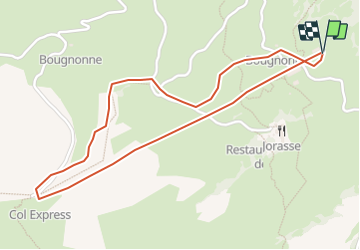

Lengte
2,4 km

Max. hoogte
2163 m

Positief hoogteverschil
302 m
Km-Effort
6,4 km

Min. hoogte
1851 m

Negatief hoogteverschil
300 m
Boucle
Ja
Datum van aanmaak :
2014-12-11 00:00:00.0
Laatste wijziging :
2014-12-11 00:00:00.0
--
Moeilijkheid : Onbekend

Gratisgps-wandelapplicatie
 SityTrail
IGN / Geografische instituten
SityTrail Plus
De wereld gaat voor u open
Over ons
Tocht Andere activiteiten van 2,4 km beschikbaar op Valais/Wallis, Martigny, Leytron. Deze tocht wordt voorgesteld door jjrochat.
Beschrijving
Montée en télésiège au Col et redescente jusqu''au départ du télésiège
Plaatsbepaling
Land:
Switzerland
Regio :
Valais/Wallis
Departement/Provincie :
Martigny
Gemeente :
Leytron
Locatie:
Unknown
Vertrek:(Dec)
Vertrek:(UTM)
356796 ; 5118602 (32T) N.
Opmerkingen