


GR10U et T depuis Gourette

LouisROGER
Gebruiker GUIDE
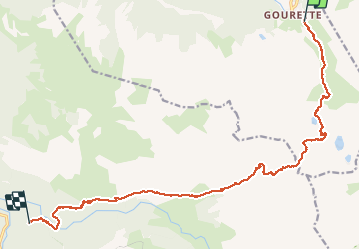

Lengte
17,8 km

Max. hoogte
2466 m

Positief hoogteverschil
1240 m
Km-Effort
35 km

Min. hoogte
1082 m

Negatief hoogteverschil
1498 m
Boucle
Neen
Datum van aanmaak :
2020-08-05 05:49:18.16
Laatste wijziging :
2020-08-05 17:07:41.244
10h50
Moeilijkheid : Zeer moeilijk

Gratisgps-wandelapplicatie
 SityTrail
IGN / Geografische instituten
SityTrail Plus
De wereld gaat voor u open
Over ons
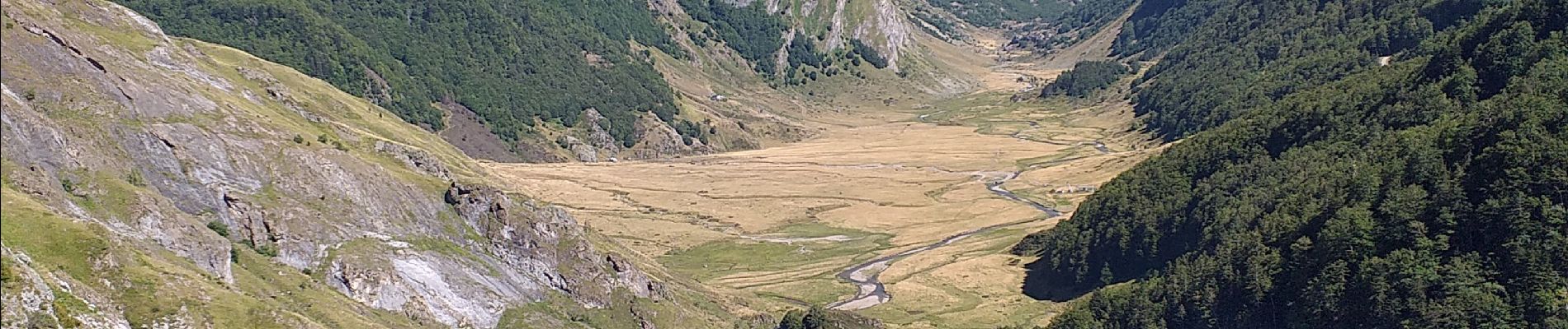
Tocht Stappen van 17,8 km beschikbaar op Nieuw-Aquitanië, Pyrénées-Atlantiques, Eaux-Bonnes. Deze tocht wordt voorgesteld door LouisROGER.
Foto's


Plaatsbepaling
Land:
France
Regio :
Nieuw-Aquitanië
Departement/Provincie :
Pyrénées-Atlantiques
Gemeente :
Eaux-Bonnes
Locatie:
Unknown
Vertrek:(Dec)
Vertrek:(UTM)
717887 ; 4759457 (30T) N.
Opmerkingen