


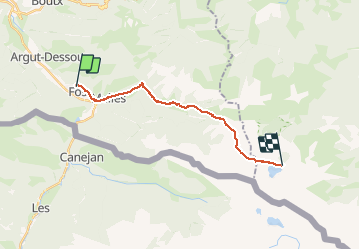
Fos - Refuge de lEtang d'Araing

ARVIEU
Gebruiker

Lengte
16,7 km

Max. hoogte
2204 m

Positief hoogteverschil
1721 m
Km-Effort
35 km

Min. hoogte
552 m

Negatief hoogteverschil
394 m
Boucle
Neen
Datum van aanmaak :
2020-10-12 19:54:56.372
Laatste wijziging :
2020-10-12 20:00:40.428
7h42
Moeilijkheid : Zeer moeilijk

Gratisgps-wandelapplicatie
 SityTrail
IGN / Geografische instituten
SityTrail Plus
De wereld gaat voor u open
Over ons
Tocht Stappen van 16,7 km beschikbaar op Occitanië, Haute-Garonne, Fos. Deze tocht wordt voorgesteld door ARVIEU.
Plaatsbepaling
Land:
France
Regio :
Occitanië
Departement/Provincie :
Haute-Garonne
Gemeente :
Fos
Locatie:
Unknown
Vertrek:(Dec)
Vertrek:(UTM)
315102 ; 4749310 (31T) N.
Opmerkingen