


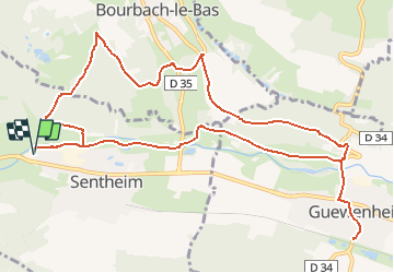
Sentheim - Bergwald - Eichwald - Guevenheim - Sentheim

patrickbeyrath
Gebruiker

Lengte
13,4 km

Max. hoogte
446 m

Positief hoogteverschil
239 m
Km-Effort
16,6 km

Min. hoogte
328 m

Negatief hoogteverschil
239 m
Boucle
Ja
Datum van aanmaak :
2020-10-23 05:50:53.702
Laatste wijziging :
2020-10-23 06:04:37.39
--
Moeilijkheid : Gemakkelijk

Gratisgps-wandelapplicatie
 SityTrail
IGN / Geografische instituten
SityTrail Plus
De wereld gaat voor u open
Over ons
Tocht Te voet van 13,4 km beschikbaar op Grand Est, Haut-Rhin, Sentheim. Deze tocht wordt voorgesteld door patrickbeyrath.
Beschrijving
Repas au restaurant de la Gare à Guewenheim
Plaatsbepaling
Land:
France
Regio :
Grand Est
Departement/Provincie :
Haut-Rhin
Gemeente :
Sentheim
Locatie:
Unknown
Vertrek:(Dec)
Vertrek:(UTM)
353278 ; 5291265 (32T) N.
Opmerkingen