


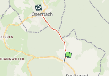
Montée d'Osenbach 2,4km

staubalex
Gebruiker

Lengte
2,4 km

Max. hoogte
382 m

Positief hoogteverschil
108 m
Km-Effort
3,5 km

Min. hoogte
273 m

Negatief hoogteverschil
0 m
Boucle
Neen
Datum van aanmaak :
2014-12-10 00:00:00.0
Laatste wijziging :
2014-12-10 00:00:00.0
13m
Moeilijkheid : Medium

Gratisgps-wandelapplicatie
 SityTrail
IGN / Geografische instituten
SityTrail Plus
De wereld gaat voor u open
Over ons
Tocht Fiets van 2,4 km beschikbaar op Grand Est, Haut-Rhin, Soultzmatt. Deze tocht wordt voorgesteld door staubalex.
Plaatsbepaling
Land:
France
Regio :
Grand Est
Departement/Provincie :
Haut-Rhin
Gemeente :
Soultzmatt
Locatie:
Unknown
Vertrek:(Dec)
Vertrek:(UTM)
368019 ; 5314200 (32T) N.
Opmerkingen