


Charentilly - PR la Choisillette avec variante - 9km 100m 1h50 - 2020 11 28

Orcal37
Gebruiker GUIDE
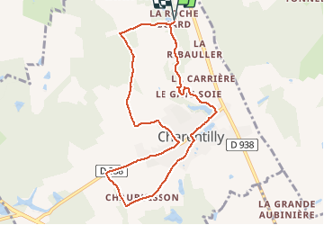

Lengte
9 km

Max. hoogte
119 m

Positief hoogteverschil
104 m
Km-Effort
10,4 km

Min. hoogte
83 m

Negatief hoogteverschil
105 m
Boucle
Ja
Datum van aanmaak :
2020-11-28 13:24:13.264
Laatste wijziging :
2020-11-28 17:53:54.458
1h50
Moeilijkheid : Gemakkelijk

Gratisgps-wandelapplicatie
 SityTrail
IGN / Geografische instituten
SityTrail Plus
De wereld gaat voor u open
Over ons
Tocht Stappen van 9 km beschikbaar op Centre-Val de Loire, Indre-et-Loire, Charentilly. Deze tocht wordt voorgesteld door Orcal37.
Beschrijving
Charentilly - PR la Choisillette avec variante - 9km 100m 1h50 - 2020 11 28
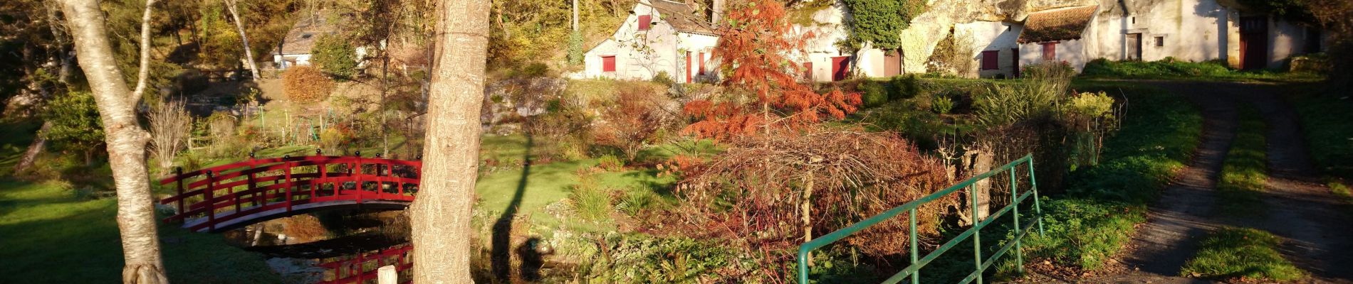
Foto's


Plaatsbepaling
Land:
France
Regio :
Centre-Val de Loire
Departement/Provincie :
Indre-et-Loire
Gemeente :
Charentilly
Locatie:
Unknown
Vertrek:(Dec)
Vertrek:(UTM)
319647 ; 5261829 (31T) N.
Opmerkingen