


Le Relais d' ASSAT - M2

mitch1952
Gebruiker
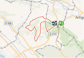

Lengte
7,6 km

Max. hoogte
324 m

Positief hoogteverschil
215 m
Km-Effort
10,5 km

Min. hoogte
236 m

Negatief hoogteverschil
216 m
Boucle
Ja
Datum van aanmaak :
2020-12-10 17:52:57.314
Laatste wijziging :
2022-06-07 14:03:12.962
2h40
Moeilijkheid : Gemakkelijk

Gratisgps-wandelapplicatie
 SityTrail
IGN / Geografische instituten
SityTrail Plus
De wereld gaat voor u open
Over ons
Tocht Te voet van 7,6 km beschikbaar op Nieuw-Aquitanië, Pyrénées-Atlantiques, Assat. Deze tocht wordt voorgesteld door mitch1952.
Plaatsbepaling
Land:
France
Regio :
Nieuw-Aquitanië
Departement/Provincie :
Pyrénées-Atlantiques
Gemeente :
Assat
Locatie:
Unknown
Vertrek:(Dec)
Vertrek:(UTM)
721841 ; 4794109 (30T) N.
Opmerkingen