


FRANCHARD-ON

patoche58
Gebruiker
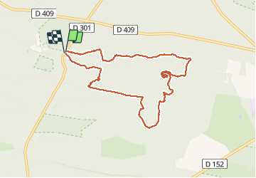

Lengte
8,3 km

Max. hoogte
142 m

Positief hoogteverschil
159 m
Km-Effort
10,4 km

Min. hoogte
92 m

Negatief hoogteverschil
159 m
Boucle
Ja
Datum van aanmaak :
2021-02-17 08:08:52.013
Laatste wijziging :
2021-02-17 09:55:51.545
1h46
Moeilijkheid : Gemakkelijk

Gratisgps-wandelapplicatie
 SityTrail
IGN / Geografische instituten
SityTrail Plus
De wereld gaat voor u open
Over ons
Tocht Noords wandelen van 8,3 km beschikbaar op Île-de-France, Seine-et-Marne, Fontainebleau. Deze tocht wordt voorgesteld door patoche58.
Beschrijving
Franchard-mont aigu-carriers
Plaatsbepaling
Land:
France
Regio :
Île-de-France
Departement/Provincie :
Seine-et-Marne
Gemeente :
Fontainebleau
Locatie:
Unknown
Vertrek:(Dec)
Vertrek:(UTM)
473286 ; 5361759 (31U) N.
Opmerkingen