


L’audibergue

Arnaud Stévenard
Gebruiker
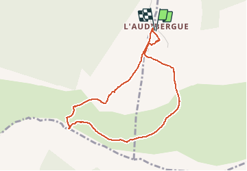

Lengte
4,3 km

Max. hoogte
1624 m

Positief hoogteverschil
285 m
Km-Effort
8,1 km

Min. hoogte
1340 m

Negatief hoogteverschil
285 m
Boucle
Ja
Datum van aanmaak :
2021-02-21 08:42:40.0
Laatste wijziging :
2021-02-21 12:40:03.959
3h56
Moeilijkheid : Gemakkelijk

Gratisgps-wandelapplicatie
 SityTrail
IGN / Geografische instituten
SityTrail Plus
De wereld gaat voor u open
Over ons
Tocht Sneeuwschoenen van 4,3 km beschikbaar op Provence-Alpes-Côte d'Azur, Alpes-Maritimes, Andon. Deze tocht wordt voorgesteld door Arnaud Stévenard.
Plaatsbepaling
Land:
France
Regio :
Provence-Alpes-Côte d'Azur
Departement/Provincie :
Alpes-Maritimes
Gemeente :
Andon
Locatie:
Unknown
Vertrek:(Dec)
Vertrek:(UTM)
321858 ; 4847547 (32T) N.
Opmerkingen