


col du page, abri rochelotte

baratta
Gebruiker
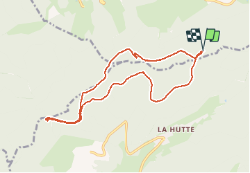

Lengte
9,1 km

Max. hoogte
1058 m

Positief hoogteverschil
218 m
Km-Effort
12 km

Min. hoogte
926 m

Negatief hoogteverschil
214 m
Boucle
Ja
Datum van aanmaak :
2021-02-22 09:18:01.67
Laatste wijziging :
2021-02-22 14:31:43.001
2h42
Moeilijkheid : Gemakkelijk

Gratisgps-wandelapplicatie
 SityTrail
IGN / Geografische instituten
SityTrail Plus
De wereld gaat voor u open
Over ons
Tocht Stappen van 9,1 km beschikbaar op Grand Est, Vogezen, Ventron. Deze tocht wordt voorgesteld door baratta.
Plaatsbepaling
Land:
France
Regio :
Grand Est
Departement/Provincie :
Vogezen
Gemeente :
Ventron
Locatie:
Unknown
Vertrek:(Dec)
Vertrek:(UTM)
342560 ; 5309277 (32T) N.
Opmerkingen