


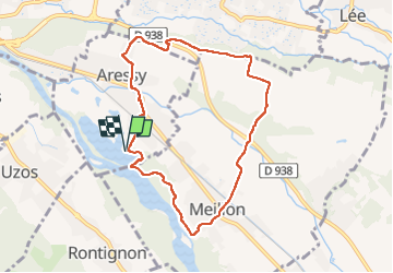
SityTrail - ARESSY Le platrau d'Aressy M2

mitch1952
Gebruiker


2h10
Moeilijkheid : Gemakkelijk

Gratisgps-wandelapplicatie
 SityTrail
IGN / Geografische instituten
SityTrail Plus
De wereld gaat voor u open
Over ons
Tocht Te voet van 8,4 km beschikbaar op Nieuw-Aquitanië, Pyrénées-Atlantiques, Aressy. Deze tocht wordt voorgesteld door mitch1952.
Beschrijving
reco faite le 01/03/2021 légère variante par rapport a la trace origine 500 m environ apres le départ le sentier suit le bord du gave (modification du terrain suite a des innondations ?)
Plaatsbepaling
Opmerkingen