


2021-03-27_17h21m46_VTT Maredsous 18.12.2011

frederic.lorimier@skynet.be
Gebruiker
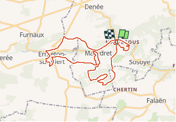

Lengte
18,9 km

Max. hoogte
299 m

Positief hoogteverschil
381 m
Km-Effort
24 km

Min. hoogte
166 m

Negatief hoogteverschil
383 m
Boucle
Ja
Datum van aanmaak :
2021-03-27 16:21:48.953
Laatste wijziging :
2021-03-27 16:21:48.057

Gratisgps-wandelapplicatie
 SityTrail
IGN / Geografische instituten
SityTrail Plus
De wereld gaat voor u open
Over ons
Tocht van 18,9 km beschikbaar op Wallonië, Namen, Anhée. Deze tocht wordt voorgesteld door frederic.lorimier@skynet.be.
Plaatsbepaling
Land:
Belgium
Regio :
Wallonië
Departement/Provincie :
Namen
Gemeente :
Anhée
Locatie:
Denée
Vertrek:(Dec)
Vertrek:(UTM)
625734 ; 5573833 (31U) N.
Opmerkingen