


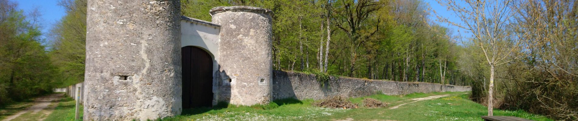
Joué-lès-Tours - 12.9km 100m 2h25 - 2021 04 03

Orcal37
Gebruiker GUIDE
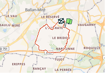

Lengte
12,9 km

Max. hoogte
107 m

Positief hoogteverschil
102 m
Km-Effort
14,2 km

Min. hoogte
77 m

Negatief hoogteverschil
102 m
Boucle
Ja
Datum van aanmaak :
2021-04-03 12:44:49.518
Laatste wijziging :
2021-04-06 12:51:05.863
2h25
Moeilijkheid : Gemakkelijk

Gratisgps-wandelapplicatie
 SityTrail
IGN / Geografische instituten
SityTrail Plus
De wereld gaat voor u open
Over ons
Tocht Stappen van 12,9 km beschikbaar op Centre-Val de Loire, Indre-et-Loire, Joué-lès-Tours. Deze tocht wordt voorgesteld door Orcal37.
Beschrijving
Joué-lès-Tours - variante PR - 12.9km 100m 2h25 - 2021 04 03
Foto's


Plaatsbepaling
Land:
France
Regio :
Centre-Val de Loire
Departement/Provincie :
Indre-et-Loire
Gemeente :
Joué-lès-Tours
Locatie:
Unknown
Vertrek:(Dec)
Vertrek:(UTM)
322322 ; 5244165 (31T) N.
Opmerkingen