


IDRON- Tour du Golf Golf-Centre équestre-EPHAD - RS

mitch1952
Gebruiker
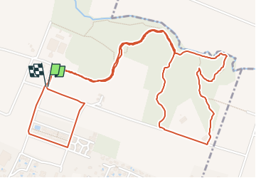

Lengte
4,4 km

Max. hoogte
250 m

Positief hoogteverschil
30 m
Km-Effort
4,8 km

Min. hoogte
241 m

Negatief hoogteverschil
28 m
Boucle
Ja
Datum van aanmaak :
2021-04-21 14:03:00.716
Laatste wijziging :
2022-06-08 13:16:25.256
2h00
Moeilijkheid : Medium

Gratisgps-wandelapplicatie
 SityTrail
IGN / Geografische instituten
SityTrail Plus
De wereld gaat voor u open
Over ons
Tocht Stappen van 4,4 km beschikbaar op Nieuw-Aquitanië, Pyrénées-Atlantiques, Idron. Deze tocht wordt voorgesteld door mitch1952.
Beschrijving
Passage près du laboratoire FAREVA (Fabrication du vaccin COVID 19), Vue sur le golf, Le Centre Equestre, le Parcours de santé et pour terminer l'EPAHD.
Plaatsbepaling
Land:
France
Regio :
Nieuw-Aquitanië
Departement/Provincie :
Pyrénées-Atlantiques
Gemeente :
Idron
Locatie:
Unknown
Vertrek:(Dec)
Vertrek:(UTM)
719225 ; 4798201 (30T) N.
Opmerkingen