


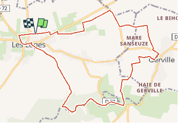
Le Bois des Loges - circuit n°10

DDLEDANDY
Gebruiker

Lengte
11,4 km

Max. hoogte
129 m

Positief hoogteverschil
119 m
Km-Effort
13 km

Min. hoogte
62 m

Negatief hoogteverschil
120 m
Boucle
Ja
Datum van aanmaak :
2021-05-17 13:44:41.6
Laatste wijziging :
2021-05-17 13:47:01.236
2h57
Moeilijkheid : Moeilijk

Gratisgps-wandelapplicatie
 SityTrail
IGN / Geografische instituten
SityTrail Plus
De wereld gaat voor u open
Over ons
Tocht Stappen van 11,4 km beschikbaar op Normandië, Seine-Maritime, Les Loges. Deze tocht wordt voorgesteld door DDLEDANDY.
Plaatsbepaling
Land:
France
Regio :
Normandië
Departement/Provincie :
Seine-Maritime
Gemeente :
Les Loges
Locatie:
Unknown
Vertrek:(Dec)
Vertrek:(UTM)
304253 ; 5508975 (31U) N.
Opmerkingen