


GPS_GT_VTT_Creuse_Vdef2

topolino
Gebruiker

Lengte
263 km

Max. hoogte
684 m

Positief hoogteverschil
5403 m
Km-Effort
335 km

Min. hoogte
304 m

Negatief hoogteverschil
5403 m
Boucle
Ja
Datum van aanmaak :
2021-06-04 11:25:38.763
Laatste wijziging :
2021-06-04 11:26:29.805
--
Moeilijkheid : Onbekend

Gratisgps-wandelapplicatie
 SityTrail
IGN / Geografische instituten
SityTrail Plus
De wereld gaat voor u open
Over ons
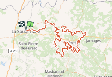
Tocht Mountainbike van 263 km beschikbaar op Nieuw-Aquitanië, Creuse, La Souterraine. Deze tocht wordt voorgesteld door topolino.
Plaatsbepaling
Land:
France
Regio :
Nieuw-Aquitanië
Departement/Provincie :
Creuse
Gemeente :
La Souterraine
Locatie:
Unknown
Vertrek:(Dec)
Vertrek:(UTM)
383680 ; 5121803 (31T) N.
Opmerkingen