


2021-05-24_Balade en pays viganais

Christiancordin
Gebruiker
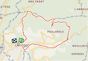

Lengte
11,4 km

Max. hoogte
577 m

Positief hoogteverschil
411 m
Km-Effort
16,9 km

Min. hoogte
205 m

Negatief hoogteverschil
413 m
Boucle
Ja
Datum van aanmaak :
2021-06-12 16:22:47.485
Laatste wijziging :
2021-06-12 16:39:56.948
3h49
Moeilijkheid : Gemakkelijk

Gratisgps-wandelapplicatie
 SityTrail
IGN / Geografische instituten
SityTrail Plus
De wereld gaat voor u open
Over ons
Tocht Te voet van 11,4 km beschikbaar op Occitanië, Gard, Le Vigan. Deze tocht wordt voorgesteld door Christiancordin.
Beschrijving
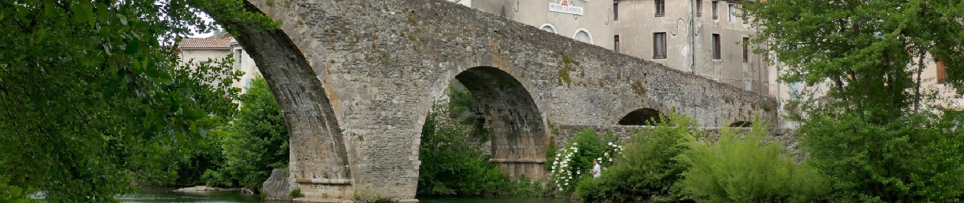
le Vigan-GR 60A-GRP-col des Mourèze-Puech du sabot-les Caumels-les plots-l'Arre-Vieux pont.
Foto's


Plaatsbepaling
Land:
France
Regio :
Occitanië
Departement/Provincie :
Gard
Gemeente :
Le Vigan
Locatie:
Unknown
Vertrek:(Dec)
Vertrek:(UTM)
548342 ; 4871029 (31T) N.
Opmerkingen