Tocht Stappen Saint-Christophe - 
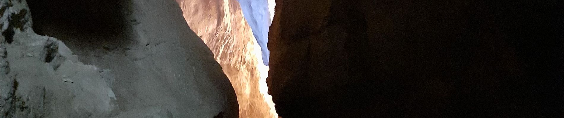
Grottes des Echelles - Photo
 cousam
cousam

Gebruiker

© OpenStreetMap contributors
Lengte
Lengte
7,4 km
Max. hoogte
Max. hoogte
595 m
Positief hoogteverschil
354 m
Km-Effort
Km-Effort  
12,1 km
Min. hoogte
Min. hoogte
421 m
Negatief hoogteverschil
348 m
Boucle
Boucle
Ja
Datum van aanmaak :
2021-06-25 12:04:27.383
Laatste wijziging :
2023-03-14 13:32:52.395

(0 Bericht)

Stappen
Stappen
3h16
Moeilijkheid : Medium

Scan deze QR-code om de tocht te openen in de SityTrail-applicatie

Gratisgps-wandelapplicatie

Logo SityTrail SityTrail

IGN / Geografische instituten

SityTrail uit de App Store downloaden SityTrail uit Google Play downloaden

Logo SityTrail SityTrail Plus

De wereld gaat voor u open

SityTrail uit de App Store downloaden SityTrail uit Google Play downloaden SityTrail op Huawei AppGallery downloaden

Over ons

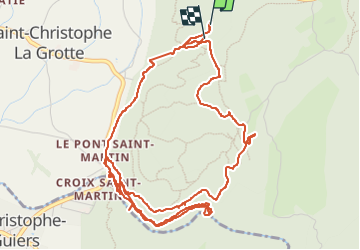
Tocht Stappen van 7,4 km beschikbaar op Auvergne-Rhône-Alpes, Savoie, Saint-Christophe. Deze tocht wordt voorgesteld door cousam.

Beschrijving

Visite
des 2 grottes de St Christophe (payantes)
puis la boucle par le pont romain ,le point de vue sur les gorges de l'échaillon, le guiers vif.
Fait un AR sur le sentier en balcon sur les gorges, jusqu'à une grotte ,apres ça ne passe pas ,faire demi tour .
retour par le GR ,avec la visite de l'habitat préhistorique de la Fru.Et retour par les escaliers en fer (sympa)

Hoogteprofiel

Foto's

Plaatsbepaling

Land:
France
Regio :
Auvergne-Rhône-Alpes
Departement/Provincie :
Savoie
Gemeente :
Saint-Christophe
Locatie:
Unknown
Vertrek:(UTM)
718271 ; 5036895 (31T) N.


Sluiten
Mijn abonnementen