


Boucle-Pic-Ansabere: 02-08-2018

chasle
Gebruiker
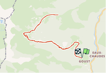

Lengte
13 km

Max. hoogte
1737 m

Positief hoogteverschil
955 m
Km-Effort
26 km

Min. hoogte
854 m

Negatief hoogteverschil
949 m
Boucle
Ja
Datum van aanmaak :
2021-07-12 07:19:17.298
Laatste wijziging :
2021-07-12 07:30:59.368

Gratisgps-wandelapplicatie
 SityTrail
IGN / Geografische instituten
SityTrail Plus
De wereld gaat voor u open
Over ons
Tocht van 13 km beschikbaar op Nieuw-Aquitanië, Pyrénées-Atlantiques, Laruns. Deze tocht wordt voorgesteld door chasle.
POI's


Plaatsbepaling
Land:
France
Regio :
Nieuw-Aquitanië
Departement/Provincie :
Pyrénées-Atlantiques
Gemeente :
Laruns
Locatie:
Unknown
Vertrek:(Dec)
Vertrek:(UTM)
708170 ; 4758601 (30T) N.
Opmerkingen