


Têtes des Chaudières

ajd26
Gebruiker
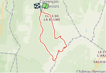

Lengte
14,4 km

Max. hoogte
2048 m

Positief hoogteverschil
1008 m
Km-Effort
28 km

Min. hoogte
1143 m

Negatief hoogteverschil
1008 m
Boucle
Ja
Datum van aanmaak :
2021-08-12 07:19:28.0
Laatste wijziging :
2021-08-13 13:08:56.16
5h21
Moeilijkheid : Moeilijk

Gratisgps-wandelapplicatie
 SityTrail
IGN / Geografische instituten
SityTrail Plus
De wereld gaat voor u open
Over ons
Tocht Stappen van 14,4 km beschikbaar op Auvergne-Rhône-Alpes, Isère, Corrençon-en-Vercors. Deze tocht wordt voorgesteld door ajd26.
Beschrijving
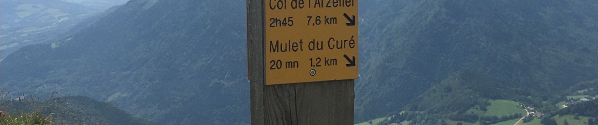
depart de Corrençon, pas de la Balme, tetes des Chaudières avec panoramas 360°
Foto's


Plaatsbepaling
Land:
France
Regio :
Auvergne-Rhône-Alpes
Departement/Provincie :
Isère
Gemeente :
Corrençon-en-Vercors
Locatie:
Unknown
Vertrek:(Dec)
Vertrek:(UTM)
698350 ; 4988784 (31T) N.
Opmerkingen