


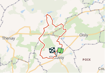
Choussy 2

Rolland Jean Pierre
Gebruiker

Lengte
13,8 km

Max. hoogte
121 m

Positief hoogteverschil
95 m
Km-Effort
15 km

Min. hoogte
95 m

Negatief hoogteverschil
94 m
Boucle
Ja
Datum van aanmaak :
2021-08-13 14:08:45.749
Laatste wijziging :
2021-08-13 14:14:13.786
3h24
Moeilijkheid : Gemakkelijk

Gratisgps-wandelapplicatie
 SityTrail
IGN / Geografische instituten
SityTrail Plus
De wereld gaat voor u open
Over ons
Tocht Te voet van 13,8 km beschikbaar op Centre-Val de Loire, Loir-et-Cher, Choussy. Deze tocht wordt voorgesteld door Rolland Jean Pierre .
Beschrijving
Rando
Plaatsbepaling
Land:
France
Regio :
Centre-Val de Loire
Departement/Provincie :
Loir-et-Cher
Gemeente :
Choussy
Locatie:
Unknown
Vertrek:(Dec)
Vertrek:(UTM)
375083 ; 5247880 (31T) N.
Opmerkingen