Tocht Stappen Rieux-Volvestre - Le balcon des Pyrénées  - Photo

Le balcon des Pyrénées

 camille6934
camille6934

Gebruiker

© OpenStreetMap contributors
Lengte
Lengte
10 km
Max. hoogte
Max. hoogte
341 m
Positief hoogteverschil
249 m
Km-Effort
Km-Effort  
13,5 km
Min. hoogte
Min. hoogte
208 m
Negatief hoogteverschil
304 m
Boucle
Boucle
Neen
Datum van aanmaak :
2021-08-17 09:06:08.0
Laatste wijziging :
2021-08-17 11:17:54.137

(0 Bericht)

Stappen
Stappen
2h11
Moeilijkheid : Medium

Scan deze QR-code om de tocht te openen in de SityTrail-applicatie

Gratisgps-wandelapplicatie

Logo SityTrail SityTrail

IGN / Geografische instituten

SityTrail uit de App Store downloaden SityTrail uit Google Play downloaden

Logo SityTrail SityTrail World

De wereld gaat voor u open

SityTrail uit de App Store downloaden SityTrail uit Google Play downloaden SityTrail op Huawei AppGallery downloaden

Over ons

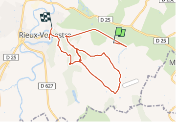
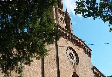
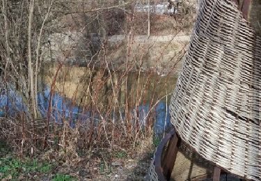
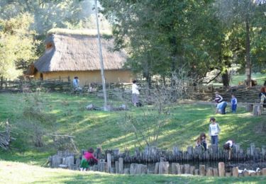
Tocht Stappen van 10 km beschikbaar op Occitanië, Haute-Garonne, Rieux-Volvestre. Deze tocht wordt voorgesteld door camille6934.

Beschrijving

Petite rando bien sportive. Beaux panorama. Pas mal de route mais très peu fréquentée.

Hoogteprofiel

Plaatsbepaling

Land:
France
Regio :
Occitanië
Departement/Provincie :
Haute-Garonne
Gemeente :
Rieux-Volvestre
Locatie:
Unknown
Vertrek:(Dec)
Vertrek:(UTM)
356004 ; 4790762 (31T) N.

Wandeltochten in de omgeving

Tocht Te voet Carbonne - Balade des coteaux - Photo
Te voet
PRO

Te voet

Gemakkelijk
Carbonne, Occitanië, Haute-Garonne, France
3,2 km | 5,1 km-effort
1h 9min
Neen
Tocht Te voet Rieux-Volvestre - Pissevinaigre - Photo
Te voet
PRO

Te voet

Gemakkelijk
Rieux-Volvestre, Occitanië, Haute-Garonne, France
6,3 km | 8,4 km-effort
1h 54min
Ja
Tocht Te voet Rieux-Volvestre - Le chemin de Saint-Roc - Photo
Te voet
PRO

Te voet

Gemakkelijk
Rieux-Volvestre, Occitanië, Haute-Garonne, France
3,5 km | 4,8 km-effort
1h 5min
Neen
Tocht Stappen Rieux-Volvestre - Belberaud 7km - Photo
Stappen
pidjam

Stappen

Heel gemakkelijk
Rieux-Volvestre, Occitanië, Haute-Garonne, France
61 km | 80 km-effort
5h 22min
Neen
Tocht Andere activiteiten Rieux-Volvestre - Rieux Plaine des Gaulois  - Photo
Andere activiteiten
pidjam

Andere activiteiten

Gemakkelijk
Rieux-Volvestre, Occitanië, Haute-Garonne, France
12,8 km | 15,1 km-effort
3h 21min
Ja
Tocht Stappen Carbonne - Carbonne abris - Photo
Stappen
pidjam

Stappen

Heel gemakkelijk
Carbonne, Occitanië, Haute-Garonne, France
11,1 km | 13,3 km-effort
2h 25min
Ja
Tocht Lopen Rieux-Volvestre - Du bourg médévial de Rieux Volvestre au village gaulois de St Julien - Photo
Lopen
tracegps

Lopen

Medium
Rieux-Volvestre, Occitanië, Haute-Garonne, France
12,2 km | 14,3 km-effort
1h 0min
Ja
Tocht Mountainbike Rieux-Volvestre - Du bourg médévial de Rieux Volvestre au village gaulois de St Julien - Photo
Mountainbike
tracegps

Mountainbike

Gemakkelijk
Rieux-Volvestre, Occitanië, Haute-Garonne, France
12,2 km | 14,3 km-effort
45min
Ja
Tocht Stappen Rieux-Volvestre - Du bourg médévial de Rieux Volvestre au village gaulois de St Julien - Photo
Stappen
tracegps

Stappen

Medium
Rieux-Volvestre, Occitanië, Haute-Garonne, France
12,2 km | 14,3 km-effort
3h 0min
Ja


Sluiten
Mijn abonnementen