


vaumeihl... melve... Thèze

PatriceCocuaud
Gebruiker

Lengte
32 km

Max. hoogte
957 m

Positief hoogteverschil
648 m
Km-Effort
40 km

Min. hoogte
518 m

Negatief hoogteverschil
646 m
Boucle
Neen
Datum van aanmaak :
2021-08-18 07:17:59.35
Laatste wijziging :
2021-08-18 11:03:04.326
3h44
Moeilijkheid : Medium

Gratisgps-wandelapplicatie
 SityTrail
IGN / Geografische instituten
SityTrail Plus
De wereld gaat voor u open
Over ons
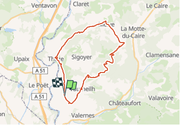
Tocht Mountainbike van 32 km beschikbaar op Provence-Alpes-Côte d'Azur, Alpes-de-Haute-Provence, Vaumeilh. Deze tocht wordt voorgesteld door PatriceCocuaud.
Plaatsbepaling
Land:
France
Regio :
Provence-Alpes-Côte d'Azur
Departement/Provincie :
Alpes-de-Haute-Provence
Gemeente :
Vaumeilh
Locatie:
Unknown
Vertrek:(Dec)
Vertrek:(UTM)
734131 ; 4907285 (31T) N.
Opmerkingen