


Jour 6 GR5 2021

Pascal Bernaud
Gebruiker
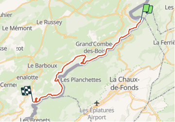

Lengte
25 km

Max. hoogte
1014 m

Positief hoogteverschil
1009 m
Km-Effort
38 km

Min. hoogte
617 m

Negatief hoogteverschil
740 m
Boucle
Neen
Datum van aanmaak :
2021-08-19 06:32:32.0
Laatste wijziging :
2021-08-19 15:13:52.303
8h41
Moeilijkheid : Zeer moeilijk

Gratisgps-wandelapplicatie
 SityTrail
IGN / Geografische instituten
SityTrail Plus
De wereld gaat voor u open
Over ons
Tocht Stappen van 25 km beschikbaar op Bourgondië-Franche-Comté, Doubs, Fournet-Blancheroche. Deze tocht wordt voorgesteld door Pascal Bernaud.
Plaatsbepaling
Land:
France
Regio :
Bourgondië-Franche-Comté
Departement/Provincie :
Doubs
Gemeente :
Fournet-Blancheroche
Locatie:
Unknown
Vertrek:(Dec)
Vertrek:(UTM)
337500 ; 5225643 (32T) N.
Opmerkingen