


bisel

bubu90
Gebruiker
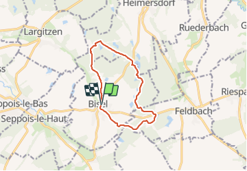

Lengte
10,6 km

Max. hoogte
446 m

Positief hoogteverschil
157 m
Km-Effort
12,7 km

Min. hoogte
401 m

Negatief hoogteverschil
161 m
Boucle
Ja
Datum van aanmaak :
2021-08-21 12:23:26.213
Laatste wijziging :
2021-08-25 09:39:17.451
2h35
Moeilijkheid : Moeilijk

Gratisgps-wandelapplicatie
 SityTrail
IGN / Geografische instituten
SityTrail Plus
De wereld gaat voor u open
Over ons
Tocht Stappen van 10,6 km beschikbaar op Grand Est, Haut-Rhin, Bisel. Deze tocht wordt voorgesteld door bubu90.
Plaatsbepaling
Land:
France
Regio :
Grand Est
Departement/Provincie :
Haut-Rhin
Gemeente :
Bisel
Locatie:
Unknown
Vertrek:(Dec)
Vertrek:(UTM)
365869 ; 5266376 (32T) N.
Opmerkingen