


Pouilly sur loire 58:rando dans les Vignes

picouleau220345
Gebruiker

Lengte
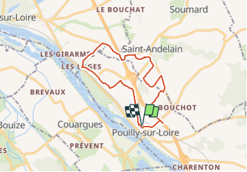
13,2 km

Max. hoogte
270 m

Positief hoogteverschil
245 m
Km-Effort
16,4 km

Min. hoogte
152 m

Negatief hoogteverschil
245 m
Boucle
Ja
Datum van aanmaak :
2021-09-01 11:18:13.868
Laatste wijziging :
2021-09-01 14:40:31.317
3h16
Moeilijkheid : Moeilijk

Gratisgps-wandelapplicatie
 SityTrail
IGN / Geografische instituten
SityTrail Plus
De wereld gaat voor u open
Over ons
Tocht Stappen van 13,2 km beschikbaar op Bourgondië-Franche-Comté, Nièvre, Pouilly-sur-Loire. Deze tocht wordt voorgesteld door picouleau220345.
Beschrijving
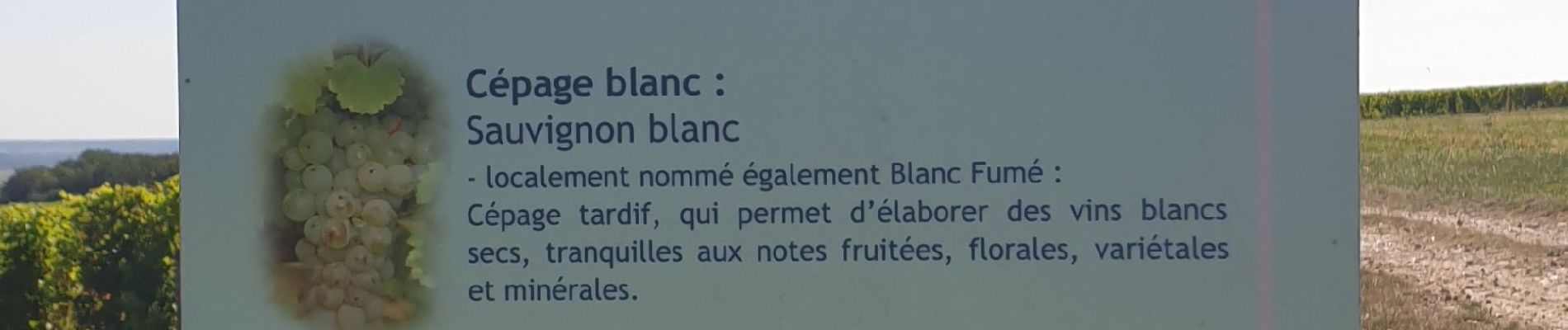
très belle randonnée avec de beaux points de vue..
un très beau Château
Foto's


21 fotos in totaal. Klik op een foto om ze allemaal in de galerij weer te geven.
Plaatsbepaling
Land:
France
Regio :
Bourgondië-Franche-Comté
Departement/Provincie :
Nièvre
Gemeente :
Pouilly-sur-Loire
Locatie:
Unknown
Vertrek:(Dec)
Vertrek:(UTM)
496701 ; 5236682 (31T) N.
Opmerkingen