


We

adamfv
Gebruiker
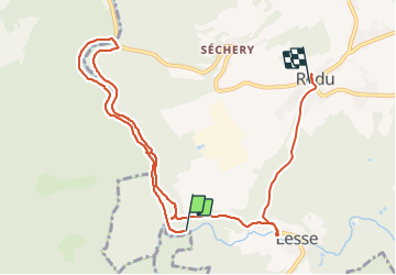

Lengte
9,8 km

Max. hoogte
371 m

Positief hoogteverschil
268 m
Km-Effort
13,1 km

Min. hoogte
250 m

Negatief hoogteverschil
175 m
Boucle
Neen
Datum van aanmaak :
2021-09-18 08:43:28.0
Laatste wijziging :
2021-09-18 13:19:49.383
4h35
Moeilijkheid : Moeilijk

Gratisgps-wandelapplicatie
 SityTrail
IGN / Geografische instituten
SityTrail Plus
De wereld gaat voor u open
Over ons
Tocht Stappen van 9,8 km beschikbaar op Wallonië, Luxemburg, Libin. Deze tocht wordt voorgesteld door adamfv.
Plaatsbepaling
Land:
Belgium
Regio :
Wallonië
Departement/Provincie :
Luxemburg
Gemeente :
Libin
Locatie:
Unknown
Vertrek:(Dec)
Vertrek:(UTM)
653391 ; 5539992 (31U) N.
Opmerkingen