


GLIERES: DECRASSAGE SUR LE PLATEAU

djeepee74
Gebruiker

Lengte
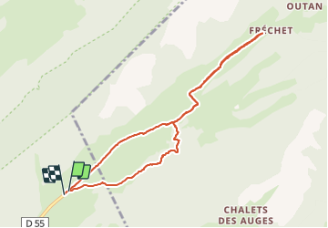
8,7 km

Max. hoogte
1446 m

Positief hoogteverschil
137 m
Km-Effort
10,6 km

Min. hoogte
1365 m

Negatief hoogteverschil
141 m
Boucle
Ja
Datum van aanmaak :
2021-09-18 12:42:26.45
Laatste wijziging :
2021-09-19 14:48:27.092
2h30
Moeilijkheid : Heel gemakkelijk

Gratisgps-wandelapplicatie
 SityTrail
IGN / Geografische instituten
SityTrail Plus
De wereld gaat voor u open
Over ons
Tocht Stappen van 8,7 km beschikbaar op Auvergne-Rhône-Alpes, Haute-Savoie, Fillière. Deze tocht wordt voorgesteld door djeepee74.
Beschrijving
BOUCLE... live 20210918
Entre les Km 1.5 et 2.1, c'est souvent très "gras".
Plaatsbepaling
Land:
France
Regio :
Auvergne-Rhône-Alpes
Departement/Provincie :
Haute-Savoie
Gemeente :
Fillière
Locatie:
Thorens-Glières
Vertrek:(Dec)
Vertrek:(UTM)
292843 ; 5093428 (32T) N.
Opmerkingen