Tocht Stappen Saint-Victor-la-Coste - St Victor la Coste Goule de Navet - Photo

St Victor la Coste Goule de Navet

 Manoune
Manoune

Gebruiker

© OpenStreetMap contributors
Lengte
Lengte
16,4 km
Max. hoogte
Max. hoogte
242 m
Positief hoogteverschil
422 m
Km-Effort
Km-Effort  
22 km
Min. hoogte
Min. hoogte
108 m
Negatief hoogteverschil
421 m
Boucle
Boucle
Ja
Datum van aanmaak :
2021-09-25 06:51:18.007
Laatste wijziging :
2021-09-28 12:47:03.309

(0 Bericht)

Stappen
Stappen
5h47
Moeilijkheid : Medium

Scan deze QR-code om de tocht te openen in de SityTrail-applicatie

Gratisgps-wandelapplicatie

Logo SityTrail SityTrail

IGN / Geografische instituten

SityTrail uit de App Store downloaden SityTrail uit Google Play downloaden

Logo SityTrail SityTrail World

De wereld gaat voor u open

SityTrail uit de App Store downloaden SityTrail uit Google Play downloaden SityTrail op Huawei AppGallery downloaden

Over ons

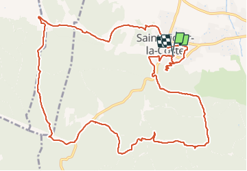
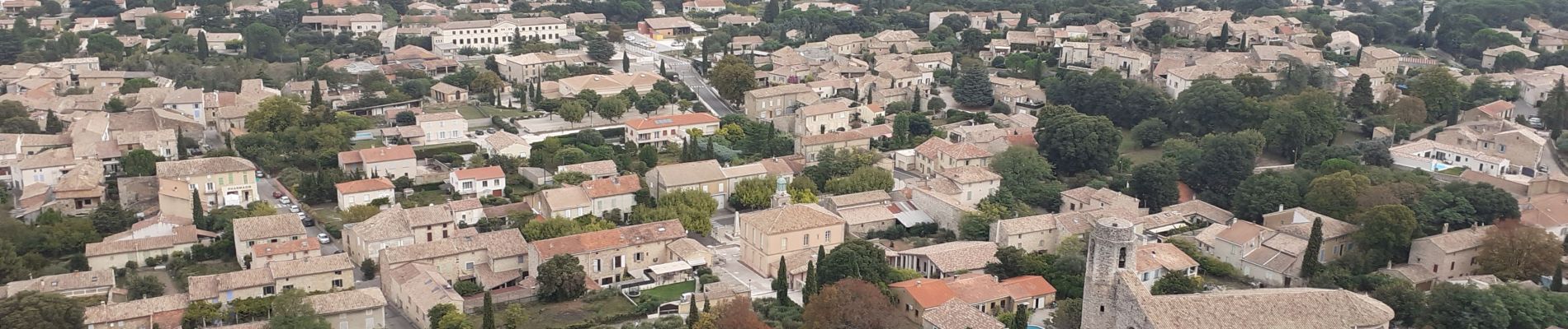
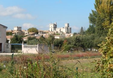
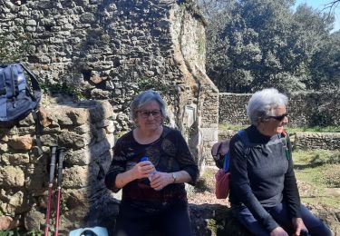
Tocht Stappen van 16,4 km beschikbaar op Occitanië, Gard, Saint-Victor-la-Coste. Deze tocht wordt voorgesteld door Manoune.

Beschrijving

Départ place de la mairie.
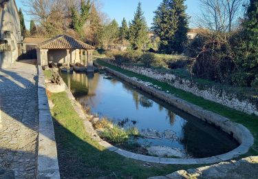
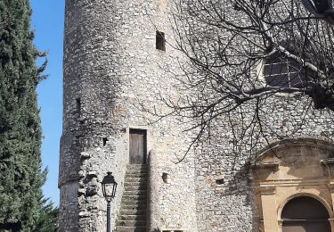
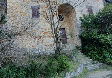
Passer devant l'église, Monter au Castellas et redescendre par le même chemin, passer à la vierge, et aux Vieux Lavoirs, rue de font de Crotade, le Bosquet, Pied Fournier, Goule de Navet, passer sous la haute tension, D 101 la suivre sur 300 m environ et prendre une piste à droite, les Loubières, les combes Pialat, Les Ferrières, Parking.

Hoogteprofiel

Foto's

Plaatsbepaling

Land:
France
Regio :
Occitanië
Departement/Provincie :
Gard
Gemeente :
Saint-Victor-la-Coste
Locatie:
Unknown
Vertrek:(UTM)
631452 ; 4879979 (31T) N.

Wandeltochten in de omgeving

Tocht Stappen Pouzilhac - Le sentier botanique - Pouzilhac - Photo
Stappen
tracegps

Stappen

Moeilijk
(4)
Pouzilhac, Occitanië, Gard, France
11,3 km | 14 km-effort
3h 30min
Ja
Tocht Stappen Saint-Laurent-des-Arbres - Les Vignobles de Lirac  - Saint Laurent des Arbres - Photo
Stappen
tracegps

Stappen

Moeilijk
(1)
Saint-Laurent-des-Arbres, Occitanië, Gard, France
15,4 km | 18,6 km-effort
4h 30min
Ja
Tocht Stappen Lirac - rando des 4 lavoirs  - Photo
Stappen
GUIDE
nadinebondoux

Stappen

Medium
Lirac, Occitanië, Gard, France
21 km | 26 km-effort
5h 36min
Ja
Tocht Stappen Tresques - Autour de Tresques - Photo
Stappen
tracegps

Stappen

Medium
(1)
Tresques, Occitanië, Gard, France
4,9 km | 5,6 km-effort
2h 0min
Ja
Tocht Stappen Saint-Victor-la-Coste - Saint victor la coste 300323 - Photo
Stappen
fario

Stappen

Zeer moeilijk
Saint-Victor-la-Coste, Occitanië, Gard, France
14,7 km | 19,4 km-effort
4h 24min
Ja
Tocht Stappen Gaujac - Gaujac 160323 - Photo
Stappen
fario

Stappen

Moeilijk
Gaujac, Occitanië, Gard, France
11 km | 14,3 km-effort
3h 15min
Ja
Tocht Stappen Lirac - Le Tanargue - Photo
Stappen
MarcLEBARON

Stappen

Medium
Lirac, Occitanië, Gard, France
16,4 km | 22 km-effort
4h 34min
Ja
Tocht Stappen Saint-Laurent-des-Arbres - St Laurent des Arbres Montagne St Genies - Photo
Stappen
Manoune

Stappen

Medium
Saint-Laurent-des-Arbres, Occitanië, Gard, France
18,8 km | 24 km-effort
6h 36min
Ja
Tocht Stappen Saint-Victor-la-Coste - Le Castellas de Saint Victor - Photo
Stappen
SabetMick

Stappen

Medium
Saint-Victor-la-Coste, Occitanië, Gard, France
5,5 km | 7,5 km-effort
2h 31min
Ja


Sluiten
Mijn abonnementen