![](/images/other/stat-length.png)
![Tocht Te voet Riomaggiore - sejour-cinq-terres-journee-5-de-riomaggiore-a-portovenere - Photo](https://media.geolcdn.com/t/1900/400/ext.pjpeg?maxdim=2&url=https%3A%2F%2Fmedia.geolcdn.com%2Ff%2F7041fc0c-36d4-45ae-a1b5-d62b7a2e2198.jpg)
sejour-cinq-terres-journee-5-de-riomaggiore-a-portovenere
chessyca
Gebruiker
![Lengte](/images/other/stat-length.png)
Lengte
24 km
![Max. hoogte](https://static1.geolcdn.com/siteimages/upload/files/1508320355ic_sort_altitude_max_24dp.png)
Max. hoogte
576 m
![Positief hoogteverschil](https://static1.geolcdn.com/siteimages/upload/files/1508320355ic_sort_den_pos_24dp.png)
Positief hoogteverschil
784 m
![Km-Effort](/images/other/stat-length.png)
Km-Effort
34 km
![Min. hoogte](https://static1.geolcdn.com/siteimages/upload/files/1508320355ic_sort_altitude_min_24dp.png)
Min. hoogte
3 m
![Negatief hoogteverschil](https://static1.geolcdn.com/siteimages/upload/files/1508320355ic_sort_den_neg_24dp.png)
Negatief hoogteverschil
803 m
![Boucle](https://static1.geolcdn.com/siteimages/upload/files/16400158638029165_repeat_loop_refresh_sync_direction_icon.png)
Boucle
Neen
Datum van aanmaak :
2021-09-27 19:03:00.511
Laatste wijziging :
2021-09-27 19:35:52.511
![Te voet](https://static1.geolcdn.com/sitytour/trail-icons/100.png)
--
Moeilijkheid : Medium
![Scan deze QR-code om de tocht te openen in de SityTrail-applicatie](https://capi.geolives.com/qq0zvz2zws4bq2lad0pu/sitytour/trails/2951855/qr.png?size=200)
Gratisgps-wandelapplicatie
Over ons
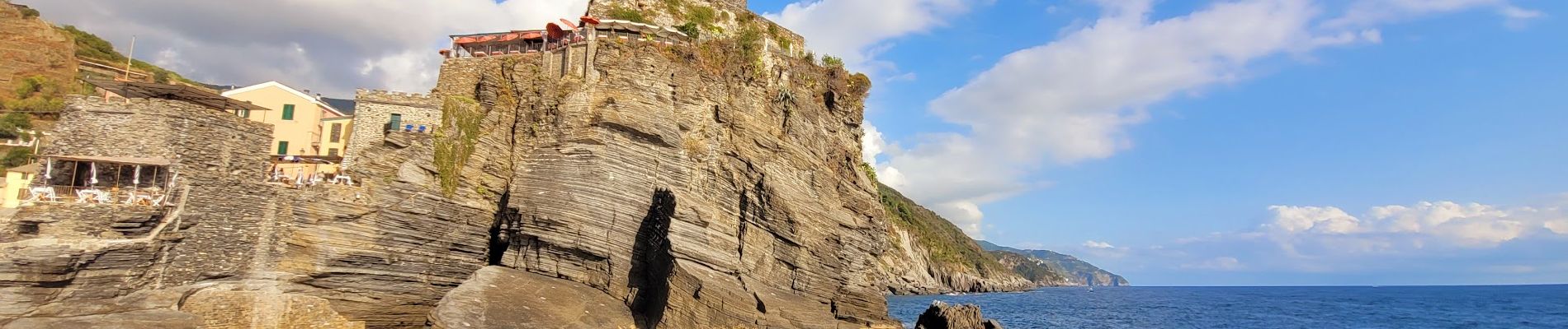
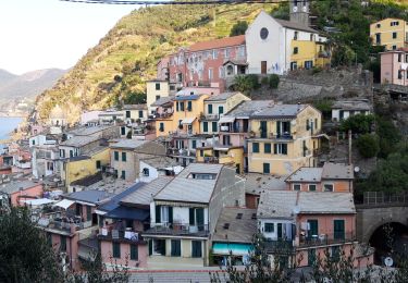
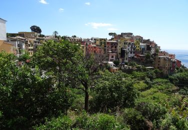
Tocht Te voet van 24 km beschikbaar op Ligurië, La Spezia, Riomaggiore. Deze tocht wordt voorgesteld door chessyca.
Beschrijving
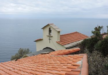
Dernière journée en randonnée pure
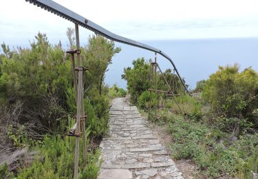
Une après midi plus "technique" nécessitant un peu de grimpette et surtout de ne pas avoir le vertige.
Superbe
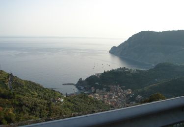
Retour en bateau de Portovenere à Levanto pour admirer une dernière fois les villages depuis la mer
Plaatsbepaling
Land:
Italy
Regio :
Ligurië
Departement/Provincie :
La Spezia
Gemeente :
Riomaggiore
Locatie:
Unknown
Vertrek:(Dec)
Vertrek:(UTM)
558922 ; 4883343 (32T) N.
Opmerkingen
Wandeltochten in de omgeving
![Tocht Stappen Vernazza - Rando cinq Terre 4ème jour Vernazza-Riomaggiore - Photo](https://media.geolcdn.com/t/375/260/ext.jpg?maxdim=2&url=https%3A%2F%2Fmedia.geolcdn.com%2Ff%2Ff9331efa-b16c-4633-8239-c8a50683b624.jpg)
![Stappen Stappen](https://static1.geolcdn.com/sitytour/trail-icons/101.png)
Rando cinq Terre 4ème jour Vernazza-Riomaggiore
Stappen
Zeer moeilijk
(1)
Vernazza,
Ligurië,
La Spezia,
Italy
![](/images/other/stat-length.png)
12,4 km | 23 km-effort
4h 26min
![](https://static1.geolcdn.com/siteimages/upload/files/16400158638029165_repeat_loop_refresh_sync_direction_icon.png)
Neen
![Tocht Stappen Vernazza - Fernacchi - manarola - Photo](https://media.geolcdn.com/t/375/260/ext.jpg?maxdim=2&url=https%3A%2F%2Fstatic1.geolcdn.com%2Fsiteimages%2Fupload%2Ffiles%2F1553511878bg_sport_marche.png)
![Stappen Stappen](https://static1.geolcdn.com/sitytour/trail-icons/101.png)
Fernacchi - manarola
Stappen
Gemakkelijk
(1)
Vernazza,
Ligurië,
La Spezia,
Italy
![](/images/other/stat-length.png)
5,8 km | 9,7 km-effort
2h 12min
![](https://static1.geolcdn.com/siteimages/upload/files/16400158638029165_repeat_loop_refresh_sync_direction_icon.png)
Neen
![Tocht Te voet Riomaggiore - Sentiero Verde Azzurro: Riomaggiore - Monterosso - Photo](https://media.geolcdn.com/t/375/260/ext.jpg?maxdim=2&url=https%3A%2F%2Fmedia.geolcdn.com%2Ff%2F21e91162-0b70-4d8b-9c83-39f7fb798cc6.jpeg)
![Te voet Te voet](https://static1.geolcdn.com/sitytour/trail-icons/100.png)
Sentiero Verde Azzurro: Riomaggiore - Monterosso
Te voet
Gemakkelijk
Riomaggiore,
Ligurië,
La Spezia,
Italy
![](/images/other/stat-length.png)
11,1 km | 19,5 km-effort
4h 25min
![](https://static1.geolcdn.com/siteimages/upload/files/16400158638029165_repeat_loop_refresh_sync_direction_icon.png)
Neen
![Tocht Te voet La Spezia - Alta Via del Golfo: La Foce - Portovenere - Photo](https://media.geolcdn.com/t/375/260/ext.jpg?maxdim=2&url=https%3A%2F%2Fmedia.geolcdn.com%2Ff%2Fba716d0b-b060-4db4-8fd9-8ae9862dae50.jpeg)
![Te voet Te voet](https://static1.geolcdn.com/sitytour/trail-icons/100.png)
Alta Via del Golfo: La Foce - Portovenere
Te voet
Medium
La Spezia,
Ligurië,
La Spezia,
Italy
![](/images/other/stat-length.png)
17,2 km | 26 km-effort
5h 54min
![](https://static1.geolcdn.com/siteimages/upload/files/16400158638029165_repeat_loop_refresh_sync_direction_icon.png)
Neen
![Tocht Te voet Riomaggiore - Alta Via delle 5 Terre: Portovenere - Monte Soviore - Foce di Dosso - Photo](https://media.geolcdn.com/t/375/260/ext.jpg?maxdim=2&url=https%3A%2F%2Fmedia.geolcdn.com%2Ff%2F456d2105-e49f-49c7-aec6-96ed27aa27d5.jpeg)
![Te voet Te voet](https://static1.geolcdn.com/sitytour/trail-icons/100.png)
Alta Via delle 5 Terre: Portovenere - Monte Soviore - Foce di Dosso
Te voet
Medium
Riomaggiore,
Ligurië,
La Spezia,
Italy
![](/images/other/stat-length.png)
21 km | 30 km-effort
6h 53min
![](https://static1.geolcdn.com/siteimages/upload/files/16400158638029165_repeat_loop_refresh_sync_direction_icon.png)
Neen
![Tocht Te voet Riccò del Golfo di Spezia - S.Benedetto – Porcale -Codeglia – Carpena – Sella di Carpena - Photo](https://media.geolcdn.com/t/375/260/ext.jpg?maxdim=2&url=https%3A%2F%2Fmedia.geolcdn.com%2Ff%2F485ff305-713c-4bb1-8358-a3035ca2ede4.jpeg)
![Te voet Te voet](https://static1.geolcdn.com/sitytour/trail-icons/100.png)
S.Benedetto – Porcale -Codeglia – Carpena – Sella di Carpena
Te voet
Gemakkelijk
Riccò del Golfo di Spezia,
Ligurië,
La Spezia,
Italy
![](/images/other/stat-length.png)
5,8 km | 9,8 km-effort
2h 13min
![](https://static1.geolcdn.com/siteimages/upload/files/16400158638029165_repeat_loop_refresh_sync_direction_icon.png)
Neen
![Tocht Te voet La Spezia - Fabiano – Mad.na dell'Olmo – Cà Pilloa – Sella Gesuela - Photo](https://media.geolcdn.com/t/375/260/ext.jpg?maxdim=2&url=https%3A%2F%2Fmedia.geolcdn.com%2Ff%2F64ba72ec-148f-4d90-a788-50975718b31b.jpeg)
![Te voet Te voet](https://static1.geolcdn.com/sitytour/trail-icons/100.png)
Fabiano – Mad.na dell'Olmo – Cà Pilloa – Sella Gesuela
Te voet
Gemakkelijk
La Spezia,
Ligurië,
La Spezia,
Italy
![](/images/other/stat-length.png)
3,3 km | 5,1 km-effort
1h 10min
![](https://static1.geolcdn.com/siteimages/upload/files/16400158638029165_repeat_loop_refresh_sync_direction_icon.png)
Neen
![Tocht Te voet Vernazza - S.Bernardino – Murro sup. - Mad.di Reggio - Photo](https://media.geolcdn.com/t/375/260/ext.jpg?maxdim=2&url=https%3A%2F%2Fmedia.geolcdn.com%2Ff%2F27de0034-8b19-42a5-b4b2-0f604b22d803.jpeg)
![Te voet Te voet](https://static1.geolcdn.com/sitytour/trail-icons/100.png)
S.Bernardino – Murro sup. - Mad.di Reggio
Te voet
Gemakkelijk
Vernazza,
Ligurië,
La Spezia,
Italy
![](/images/other/stat-length.png)
4,7 km | 7,4 km-effort
1h 40min
![](https://static1.geolcdn.com/siteimages/upload/files/16400158638029165_repeat_loop_refresh_sync_direction_icon.png)
Neen
![Tocht Te voet La Spezia - Pegazzano – Biassa – S.Antonio – Schiara - Photo](https://media.geolcdn.com/t/375/260/ext.jpg?maxdim=2&url=https%3A%2F%2Fmedia.geolcdn.com%2Ff%2Ff5823fa0-46d8-488d-83ac-e0137eda51cf.jpeg)
![Te voet Te voet](https://static1.geolcdn.com/sitytour/trail-icons/100.png)
Pegazzano – Biassa – S.Antonio – Schiara
Te voet
Gemakkelijk
La Spezia,
Ligurië,
La Spezia,
Italy
![](/images/other/stat-length.png)
6 km | 11,2 km-effort
2h 33min
![](https://static1.geolcdn.com/siteimages/upload/files/16400158638029165_repeat_loop_refresh_sync_direction_icon.png)
Neen