Tocht Stappen Chessy - Châteaux, vignes et pierres dorées - Photo

Châteaux, vignes et pierres dorées

 trietsch
trietsch

Gebruiker

© OpenStreetMap contributors
Lengte
Lengte
9,5 km
Max. hoogte
Max. hoogte
391 m
Positief hoogteverschil
253 m
Km-Effort
Km-Effort  
12,9 km
Min. hoogte
Min. hoogte
214 m
Negatief hoogteverschil
253 m
Boucle
Boucle
Ja
Datum van aanmaak :
2021-10-11 18:49:06.931
Laatste wijziging :
2024-05-20 19:09:51.367

(0 Bericht)

Stappen
Stappen
2h56
Moeilijkheid : Moeilijk

Scan deze QR-code om de tocht te openen in de SityTrail-applicatie

Gratisgps-wandelapplicatie

Logo SityTrail SityTrail

IGN / Geografische instituten

SityTrail uit de App Store downloaden SityTrail uit Google Play downloaden

Logo SityTrail SityTrail Plus

De wereld gaat voor u open

SityTrail uit de App Store downloaden SityTrail uit Google Play downloaden SityTrail op Huawei AppGallery downloaden

Over ons

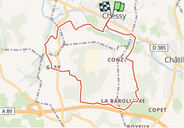
Tocht Stappen van 9,5 km beschikbaar op Auvergne-Rhône-Alpes, Rhône, Chessy. Deze tocht wordt voorgesteld door trietsch.

Hoogteprofiel

POI's

POI Chessy - Parking de la mairie - Photo
trietsch
POI Châtillon - À gauche à l'intersection - Photo
trietsch
POI Châtillon - Route vers la droite - Photo
trietsch
POI Saint-Germain-Nuelles - Chemin de terre à droite après station gaz - Photo
trietsch
SAINT-GERMAIN-NUELLES 
POI Saint-Germain-Nuelles - Sentier qui part sur la gauche - Photo
trietsch
SAINT-GERMAIN-NUELLES 
POI Saint-Germain-Nuelles - À droite à la route - Photo
trietsch
SAINT-GERMAIN-NUELLES 
POI Le Breuil - À droite avant le pont - Photo
trietsch
POI Chessy - Chateau de Courbeville - Photo
trietsch
POI Chessy - À gauche vers le pont - Photo
trietsch
POI Chessy - Parking de la mairie - Photo
trietsch

Plaatsbepaling

Land:
France
Regio :
Auvergne-Rhône-Alpes
Departement/Provincie :
Rhône
Gemeente :
Chessy
Locatie:
Unknown
Vertrek:(Dec)
Vertrek:(UTM)
625866 ; 5082730 (31T) N.


Sluiten
Mijn abonnementen