


Trip 2021-10-12

Alain Derrives
Gebruiker

Lengte
51 km

Max. hoogte
704 m

Positief hoogteverschil
1086 m
Km-Effort
65 km

Min. hoogte
244 m

Negatief hoogteverschil
1082 m
Boucle
Ja
Datum van aanmaak :
2021-10-13 12:51:41.146
Laatste wijziging :
2021-10-13 12:53:24.72
4h31
Moeilijkheid : Zeer moeilijk

Gratisgps-wandelapplicatie
 SityTrail
IGN / Geografische instituten
SityTrail Plus
De wereld gaat voor u open
Over ons
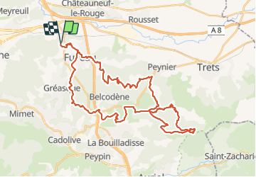
Tocht Mountainbike van 51 km beschikbaar op Provence-Alpes-Côte d'Azur, Bouches-du-Rhône, Fuveau. Deze tocht wordt voorgesteld door Alain Derrives.
Plaatsbepaling
Land:
France
Regio :
Provence-Alpes-Côte d'Azur
Departement/Provincie :
Bouches-du-Rhône
Gemeente :
Fuveau
Locatie:
Unknown
Vertrek:(Dec)
Vertrek:(UTM)
705726 ; 4815394 (31T) N.
Opmerkingen