


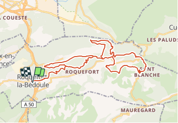
2021-11-01_12h14m43_2021-11-01_546938472_Singletracks en série – Single des Rouvières Circuit à partir de Roquefort-la-Bédoule

HG74250
Gebruiker

Lengte
26 km

Max. hoogte
400 m

Positief hoogteverschil
579 m
Km-Effort
33 km

Min. hoogte
239 m

Negatief hoogteverschil
578 m
Boucle
Ja
Datum van aanmaak :
2021-11-01 11:14:45.431
Laatste wijziging :
2021-11-01 11:16:23.217
2h18
Moeilijkheid : Moeilijk

Gratisgps-wandelapplicatie
 SityTrail
IGN / Geografische instituten
SityTrail Plus
De wereld gaat voor u open
Over ons
Tocht Mountainbike van 26 km beschikbaar op Provence-Alpes-Côte d'Azur, Bouches-du-Rhône, Roquefort-la-Bédoule. Deze tocht wordt voorgesteld door HG74250.
Plaatsbepaling
Land:
France
Regio :
Provence-Alpes-Côte d'Azur
Departement/Provincie :
Bouches-du-Rhône
Gemeente :
Roquefort-la-Bédoule
Locatie:
Unknown
Vertrek:(Dec)
Vertrek:(UTM)
710403 ; 4791459 (31T) N.
Opmerkingen