


11053690-Pechbusque 11

pidjam
Gebruiker

Lengte
11,1 km

Max. hoogte
278 m

Positief hoogteverschil
227 m
Km-Effort
14,2 km

Min. hoogte
181 m

Negatief hoogteverschil
228 m
Boucle
Ja
Datum van aanmaak :
2021-11-04 09:32:23.159
Laatste wijziging :
2021-11-04 09:53:26.949
3h13
Moeilijkheid : Moeilijk

Gratisgps-wandelapplicatie
 SityTrail
IGN / Geografische instituten
SityTrail Plus
De wereld gaat voor u open
Over ons
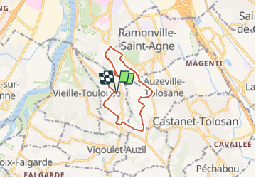
Tocht Stappen van 11,1 km beschikbaar op Occitanië, Haute-Garonne, Pechbusque. Deze tocht wordt voorgesteld door pidjam.
Beschrijving
marche à Pechbusque pas encore faite mais bientôt
Plaatsbepaling
Land:
France
Regio :
Occitanië
Departement/Provincie :
Haute-Garonne
Gemeente :
Pechbusque
Locatie:
Unknown
Vertrek:(Dec)
Vertrek:(UTM)
375548 ; 4820498 (31T) N.
Opmerkingen