


Cipiere World

jlrayon
Gebruiker
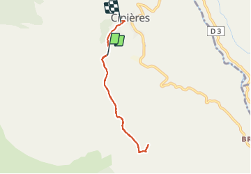

Lengte
6,5 km

Max. hoogte
991 m

Positief hoogteverschil
208 m
Km-Effort
9,5 km

Min. hoogte
763 m

Negatief hoogteverschil
273 m
Boucle
Neen
Datum van aanmaak :
2021-11-17 09:56:42.96
Laatste wijziging :
2021-11-17 18:06:24.129
5h27
Moeilijkheid : Medium

Gratisgps-wandelapplicatie
 SityTrail
IGN / Geografische instituten
SityTrail Plus
De wereld gaat voor u open
Over ons
Tocht Stappen van 6,5 km beschikbaar op Provence-Alpes-Côte d'Azur, Alpes-Maritimes, Cipières. Deze tocht wordt voorgesteld door jlrayon.
Plaatsbepaling
Land:
France
Regio :
Provence-Alpes-Côte d'Azur
Departement/Provincie :
Alpes-Maritimes
Gemeente :
Cipières
Locatie:
Unknown
Vertrek:(Dec)
Vertrek:(UTM)
335069 ; 4849075 (32T) N.
Opmerkingen