


D30 - GR 10

loic09
Gebruiker
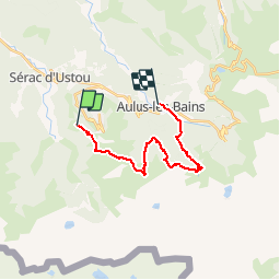

Lengte
17,2 km

Max. hoogte
1656 m

Positief hoogteverschil
790 m
Km-Effort
30 km

Min. hoogte
754 m

Negatief hoogteverschil
1403 m
Boucle
Neen
Datum van aanmaak :
2014-12-10 00:00:00.0
Laatste wijziging :
2014-12-10 00:00:00.0
6h03
Moeilijkheid : Medium

Gratisgps-wandelapplicatie
 SityTrail
IGN / Geografische instituten
SityTrail Plus
De wereld gaat voor u open
Over ons
Tocht Stappen van 17,2 km beschikbaar op Occitanië, Ariège, Ustou. Deze tocht wordt voorgesteld door loic09.
Beschrijving
Col de Fitte/Aulus Les Bains

Plaatsbepaling
Land:
France
Regio :
Occitanië
Departement/Provincie :
Ariège
Gemeente :
Ustou
Locatie:
Unknown
Vertrek:(Dec)
Vertrek:(UTM)
359884 ; 4738003 (31T) N.
Opmerkingen