


collège rognes. j.f. Marie.nicoline

NADINE52
Gebruiker

Lengte
9,7 km

Max. hoogte
302 m

Positief hoogteverschil
137 m
Km-Effort
11,5 km

Min. hoogte
240 m

Negatief hoogteverschil
135 m
Boucle
Ja
Datum van aanmaak :
2021-12-21 09:29:27.105
Laatste wijziging :
2021-12-21 13:29:29.463
2h34
Moeilijkheid : Medium

Gratisgps-wandelapplicatie
 SityTrail
IGN / Geografische instituten
SityTrail Plus
De wereld gaat voor u open
Over ons
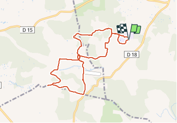
Tocht Stappen van 9,7 km beschikbaar op Provence-Alpes-Côte d'Azur, Bouches-du-Rhône, Rognes. Deze tocht wordt voorgesteld door NADINE52.
Plaatsbepaling
Land:
France
Regio :
Provence-Alpes-Côte d'Azur
Departement/Provincie :
Bouches-du-Rhône
Gemeente :
Rognes
Locatie:
Unknown
Vertrek:(Dec)
Vertrek:(UTM)
687513 ; 4836011 (31T) N.
Opmerkingen