


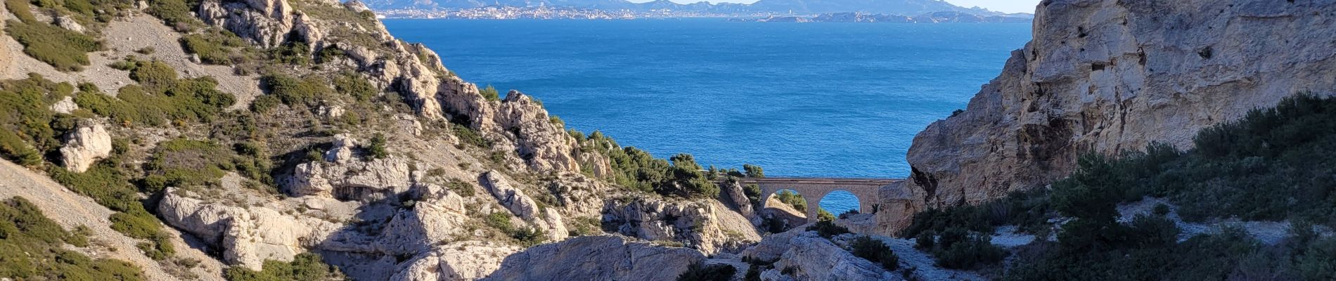
de Niolon à l'Erévine

amiral13
Gebruiker GUIDE
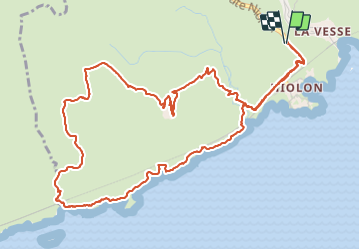

Lengte
7,3 km

Max. hoogte
210 m

Positief hoogteverschil
280 m
Km-Effort
11,1 km

Min. hoogte
13 m

Negatief hoogteverschil
280 m
Boucle
Ja
Datum van aanmaak :
2022-01-08 13:16:44.502
Laatste wijziging :
2022-01-18 17:17:01.256
2h47
Moeilijkheid : Gemakkelijk

Gratisgps-wandelapplicatie
 SityTrail
IGN / Geografische instituten
SityTrail Plus
De wereld gaat voor u open
Over ons
Tocht Stappen van 7,3 km beschikbaar op Provence-Alpes-Côte d'Azur, Bouches-du-Rhône, Le Rove. Deze tocht wordt voorgesteld door amiral13.
Beschrijving
Si vous en avez le temps, faites un aller-retour jusqu'au port de Méjean au départ de la calanque de l'Erevine.
Foto's


Plaatsbepaling
Land:
France
Regio :
Provence-Alpes-Côte d'Azur
Departement/Provincie :
Bouches-du-Rhône
Gemeente :
Le Rove
Locatie:
Unknown
Vertrek:(Dec)
Vertrek:(UTM)
682886 ; 4801279 (31T) N.
Opmerkingen
Top