


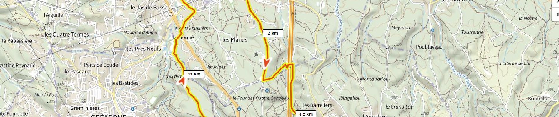
Les Planes, écopont, Belcodène, la Galère, forêt de Gréasque

ericberlin
Gebruiker

Lengte
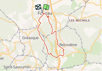
13,4 km

Max. hoogte
397 m

Positief hoogteverschil
258 m
Km-Effort
16,8 km

Min. hoogte
255 m

Negatief hoogteverschil
258 m
Boucle
Ja
Datum van aanmaak :
2022-02-02 11:07:23.743
Laatste wijziging :
2023-06-14 13:51:51.897
3h49
Moeilijkheid : Moeilijk
1h10
Moeilijkheid : Gemakkelijk

Gratisgps-wandelapplicatie
 SityTrail
IGN / Geografische instituten
SityTrail Plus
De wereld gaat voor u open
Over ons
Tocht Stappen van 13,4 km beschikbaar op Provence-Alpes-Côte d'Azur, Bouches-du-Rhône, Fuveau. Deze tocht wordt voorgesteld door ericberlin.
Foto's


Plaatsbepaling
Land:
France
Regio :
Provence-Alpes-Côte d'Azur
Departement/Provincie :
Bouches-du-Rhône
Gemeente :
Fuveau
Locatie:
Unknown
Vertrek:(Dec)
Vertrek:(UTM)
706984 ; 4814357 (31T) N.
Opmerkingen