Tocht Mountainbike Nassogne - Promenade VTT 3 - Photo

Randonnées du CGT GUIDE+

© OpenStreetMap contributors
Lengte
Lengte
21 km
Max. hoogte
Max. hoogte
542 m
Positief hoogteverschil
486 m
Km-Effort
Km-Effort  
27 km
Min. hoogte
Min. hoogte
294 m
Negatief hoogteverschil
486 m
Boucle
Boucle
Ja
Datum van aanmaak :
2022-02-08 11:24:49.763
Laatste wijziging :
2022-02-21 10:06:05.596

(0 Bericht)

Mountainbike
Mountainbike
1h53
Moeilijkheid : Medium

Scan deze QR-code om de tocht te openen in de SityTrail-applicatie

Gratisgps-wandelapplicatie

Logo SityTrail SityTrail

IGN / Geografische instituten

SityTrail uit de App Store downloaden SityTrail uit Google Play downloaden

Logo SityTrail SityTrail World

De wereld gaat voor u open

SityTrail uit de App Store downloaden SityTrail uit Google Play downloaden SityTrail op Huawei AppGallery downloaden

Over ons

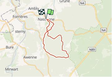
Tocht Mountainbike van 21 km beschikbaar op Wallonië, Luxemburg, Nassogne. Deze tocht wordt voorgesteld door Commissariat général au Tourisme.

Beschrijving

Trail created by Famenne-Ardenne.


Met dit circuit vanuit Nassogne, kunnen bosliefhebbers hun hartje halen ; het loopt door het prachtige Ardens Massief en het Fourneau Saint-Michel openluchtmuseum.


Hoogteprofiel

Foto's

Plaatsbepaling

Land:
Belgium
Regio :
Wallonië
Departement/Provincie :
Luxemburg
Gemeente :
Nassogne
Locatie:
Unknown
Vertrek:(UTM)
667368 ; 5555588 (31U) N.

Wandeltochten in de omgeving

Tocht Stappen Tellin - GG-Lu-13_Grupont - Poix-Saint-Hubert - Photo
Stappen
PRO

Stappen

Zeer moeilijk
(2)
Tellin, Wallonië, Luxemburg, Belgium
26 km | 34 km-effort
7h 23min
Neen
Tocht Stappen Tellin - Balade à Grupont - Photo
Stappen
GUIDE
Desrumaux

Stappen

Gemakkelijk
(1)
Tellin, Wallonië, Luxemburg, Belgium
8,4 km | 11,9 km-effort
2h 33min
Ja
Tocht Stappen Tellin - Grupont - Promenade du Bois du Machi - Photo
Stappen
GUIDE+

Stappen

Medium
(1)
Tellin, Wallonië, Luxemburg, Belgium
8,6 km | 12,6 km-effort
2h 37min
Ja
Tocht Mountainbike Nassogne - Nassogne - Circuit VTT rouge 4 - Photo
Mountainbike
GUIDE+

Mountainbike

Moeilijk
(1)
Nassogne, Wallonië, Luxemburg, Belgium
26 km | 36 km-effort
2h 16min
Ja
Tocht Stappen Nassogne - Grune - Promenade du Chevenys (NG 11) - Photo
Stappen
GUIDE+

Stappen

Medium
(3)
Nassogne, Wallonië, Luxemburg, Belgium
8,4 km | 11,6 km-effort
2h 27min
Ja
Tocht Stappen Nassogne - Grune - Promenade des Prés (NG 10) - Photo
Stappen
GUIDE+

Stappen

Gemakkelijk
(1)
Nassogne, Wallonië, Luxemburg, Belgium
4,4 km | 5,3 km-effort
1h 10min
Ja
Tocht Stappen Nassogne - Forrières/Lesterny - Promenade Saint-Martin (NG 08) - Photo
Stappen
GUIDE+

Stappen

Medium
(4)
Nassogne, Wallonië, Luxemburg, Belgium
7,3 km | 9 km-effort
1h 57min
Ja
Tocht Stappen Nassogne - Forrières - Promenade de Cocher (NG 07) - Photo
Stappen
GUIDE+

Stappen

Medium
(2)
Nassogne, Wallonië, Luxemburg, Belgium
5,4 km | 6,7 km-effort
1h 28min
Ja
Tocht Stappen Nassogne - Ambly - Promenade de Javingue (NG 02) - Photo
Stappen
GUIDE+

Stappen

Medium
(7)
Nassogne, Wallonië, Luxemburg, Belgium
9 km | 11,6 km-effort
2h 28min
Ja


Sluiten
Mijn abonnementen