


Fleche Bleu Dalheim

SityTrail - itinéraires balisés pédestres
Tous les sentiers balisés d’Europe GUIDE+

Lengte
7,6 km

Max. hoogte
382 m

Positief hoogteverschil
150 m
Km-Effort
9,6 km

Min. hoogte
282 m

Negatief hoogteverschil
149 m
Boucle
Ja

Markering
Datum van aanmaak :
2022-02-09 15:19:40.576
Laatste wijziging :
2022-03-10 09:23:59.16
2h10
Moeilijkheid : Gemakkelijk

Gratisgps-wandelapplicatie
 SityTrail
IGN / Geografische instituten
SityTrail Plus
De wereld gaat voor u open
Over ons
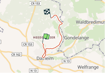
Tocht Te voet van 7,6 km beschikbaar op Onbekend, Canton Remich, Dalheim. Deze tocht wordt voorgesteld door SityTrail - itinéraires balisés pédestres.
Foto's


Plaatsbepaling
Land:
Luxembourg
Regio :
Onbekend
Departement/Provincie :
Canton Remich
Gemeente :
Dalheim
Locatie:
Unknown
Vertrek:(Dec)
Vertrek:(UTM)
301418 ; 5492330 (32U) N.
Opmerkingen