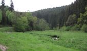
Kell 1
SityTrail - itinéraires balisés pédestres
Tous les sentiers balisés d’Europe GUIDE+

Lengte
6,8 km

Max. hoogte
568 m

Positief hoogteverschil
145 m

Km-Effort
8,7 km

Min. hoogte
459 m

Negatief hoogteverschil
138 m
Boucle
Neen

Markering
Datum van aanmaak :
2022-02-11 12:48:14.2
Laatste wijziging :
2022-02-11 12:48:14.2
1h58
Moeilijkheid : Gemakkelijk

Gratisgps-wandelapplicatie
Over ons
Tocht Te voet van 6,8 km beschikbaar op Rijnland-Palts, Landkreis Trier-Saarburg, Kell am See. Deze tocht wordt voorgesteld door SityTrail - itinéraires balisés pédestres.
Beschrijving
Trail created by Naturpark Saar-Hunsrück.
Wegeverlauf hat sich im Jahr 2013 grundsätzlich geändert
Symbol: Roter Text Rl1 in rotem Rechteck auf weißem Grund
Plaatsbepaling
Land:
Germany
Regio :
Rijnland-Palts
Departement/Provincie :
Landkreis Trier-Saarburg
Gemeente :
Kell am See
Locatie:
Unknown
Vertrek:(Dec)
Vertrek:(UTM)
343080 ; 5500304 (32U) N.
Opmerkingen


 SityTrail


