


st_riedmatten

My Switzerland
Optez pour le retour à la nature GUIDE+
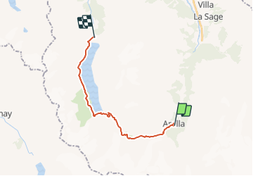

Lengte
16,7 km

Max. hoogte
2900 m

Positief hoogteverschil
1125 m
Km-Effort
31 km

Min. hoogte
1993 m

Negatief hoogteverschil
985 m
Boucle
Neen
Datum van aanmaak :
2014-12-10 00:00:00.0
Laatste wijziging :
2014-12-10 00:00:00.0
5h33
Moeilijkheid : Onbekend

Gratisgps-wandelapplicatie
 SityTrail
IGN / Geografische instituten
SityTrail Plus
De wereld gaat voor u open
Over ons
Tocht Stappen van 16,7 km beschikbaar op Valais/Wallis, Hérens, Evolène. Deze tocht wordt voorgesteld door My Switzerland.
Plaatsbepaling
Land:
Switzerland
Regio :
Valais/Wallis
Departement/Provincie :
Hérens
Gemeente :
Evolène
Locatie:
Unknown
Vertrek:(Dec)
Vertrek:(UTM)
382484 ; 5097873 (32T) N.
Opmerkingen