


IT-211

SityTrail - itinéraires balisés pédestres
Tous les sentiers balisés d’Europe GUIDE+
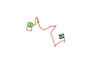

Lengte
10,2 km

Max. hoogte
1842 m

Positief hoogteverschil
441 m
Km-Effort
16,3 km

Min. hoogte
1537 m

Negatief hoogteverschil
499 m
Boucle
Neen

Markering
Datum van aanmaak :
2022-02-14 21:39:55.809
Laatste wijziging :
2022-02-28 13:26:57.891
3h42
Moeilijkheid : Gemakkelijk

Gratisgps-wandelapplicatie
 SityTrail
IGN / Geografische instituten
SityTrail Plus
De wereld gaat voor u open
Over ons
Tocht Te voet van 10,2 km beschikbaar op Friuli-Venezia Giulia, Onbekend, Forni di Sopra. Deze tocht wordt voorgesteld door SityTrail - itinéraires balisés pédestres.
Beschrijving
Trail created by Club Alpino Italiano.
Plaatsbepaling
Land:
Italy
Regio :
Friuli-Venezia Giulia
Departement/Provincie :
Onbekend
Gemeente :
Forni di Sopra
Locatie:
Unknown
Vertrek:(Dec)
Vertrek:(UTM)
312805 ; 5146998 (33T) N.
Opmerkingen