


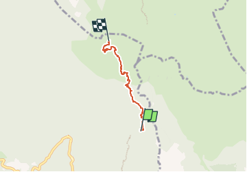

6 km | 14,5 km-effort

Tous les sentiers balisés d’Europe PRO


Gratisgps-wandelapplicatie
 SityTrail
IGN / Geografische instituten
SityTrail World
De wereld gaat voor u open
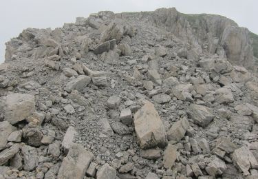
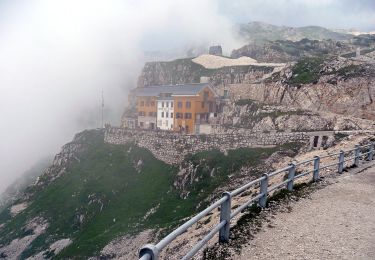
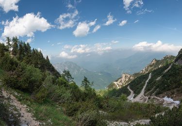
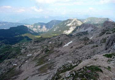
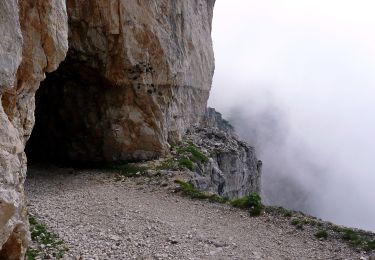
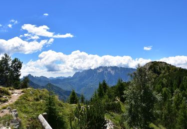
Tocht Te voet van 3,3 km beschikbaar op Trento-Zuid-Tirol, Provincia di Trento, Vallarsa. Deze tocht wordt voorgesteld door SityTrail - itinéraires balisés pédestres.
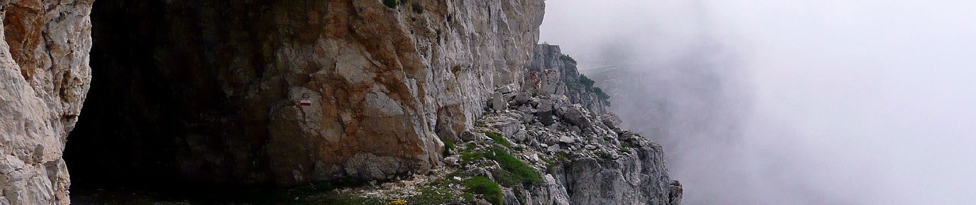
Trail created by Società degli Alpinisti Tridentini.
Website: http://www.sat.tn.it/
 "
data-pinterest-text="Pin it"
data-tweet-text="share on twitter"
data-facebook-share-url="https://www.sitytrail.com/nl/trails/3117141-vallarsa--via-ferrata-xpasquale-baglionix/?photo=1#lg=1&slide=1"
data-twitter-share-url="https://www.sitytrail.com/nl/trails/3117141-vallarsa--via-ferrata-xpasquale-baglionix/?photo=1#lg=1&slide=1"
data-googleplus-share-url="https://www.sitytrail.com/nl/trails/3117141-vallarsa--via-ferrata-xpasquale-baglionix/?photo=1#lg=1&slide=1"
data-pinterest-share-url="https://www.sitytrail.com/nl/trails/3117141-vallarsa--via-ferrata-xpasquale-baglionix/?photo=1#lg=1&slide=1">
"
data-pinterest-text="Pin it"
data-tweet-text="share on twitter"
data-facebook-share-url="https://www.sitytrail.com/nl/trails/3117141-vallarsa--via-ferrata-xpasquale-baglionix/?photo=1#lg=1&slide=1"
data-twitter-share-url="https://www.sitytrail.com/nl/trails/3117141-vallarsa--via-ferrata-xpasquale-baglionix/?photo=1#lg=1&slide=1"
data-googleplus-share-url="https://www.sitytrail.com/nl/trails/3117141-vallarsa--via-ferrata-xpasquale-baglionix/?photo=1#lg=1&slide=1"
data-pinterest-share-url="https://www.sitytrail.com/nl/trails/3117141-vallarsa--via-ferrata-xpasquale-baglionix/?photo=1#lg=1&slide=1">
 "
data-pinterest-text="Pin it"
data-tweet-text="share on twitter"
data-facebook-share-url="https://www.sitytrail.com/nl/trails/3117141-vallarsa--via-ferrata-xpasquale-baglionix/?photo=2#lg=1&slide=2"
data-twitter-share-url="https://www.sitytrail.com/nl/trails/3117141-vallarsa--via-ferrata-xpasquale-baglionix/?photo=2#lg=1&slide=2"
data-googleplus-share-url="https://www.sitytrail.com/nl/trails/3117141-vallarsa--via-ferrata-xpasquale-baglionix/?photo=2#lg=1&slide=2"
data-pinterest-share-url="https://www.sitytrail.com/nl/trails/3117141-vallarsa--via-ferrata-xpasquale-baglionix/?photo=2#lg=1&slide=2">
"
data-pinterest-text="Pin it"
data-tweet-text="share on twitter"
data-facebook-share-url="https://www.sitytrail.com/nl/trails/3117141-vallarsa--via-ferrata-xpasquale-baglionix/?photo=2#lg=1&slide=2"
data-twitter-share-url="https://www.sitytrail.com/nl/trails/3117141-vallarsa--via-ferrata-xpasquale-baglionix/?photo=2#lg=1&slide=2"
data-googleplus-share-url="https://www.sitytrail.com/nl/trails/3117141-vallarsa--via-ferrata-xpasquale-baglionix/?photo=2#lg=1&slide=2"
data-pinterest-share-url="https://www.sitytrail.com/nl/trails/3117141-vallarsa--via-ferrata-xpasquale-baglionix/?photo=2#lg=1&slide=2">
 "
data-pinterest-text="Pin it"
data-tweet-text="share on twitter"
data-facebook-share-url="https://www.sitytrail.com/nl/trails/3117141-vallarsa--via-ferrata-xpasquale-baglionix/?photo=3#lg=1&slide=3"
data-twitter-share-url="https://www.sitytrail.com/nl/trails/3117141-vallarsa--via-ferrata-xpasquale-baglionix/?photo=3#lg=1&slide=3"
data-googleplus-share-url="https://www.sitytrail.com/nl/trails/3117141-vallarsa--via-ferrata-xpasquale-baglionix/?photo=3#lg=1&slide=3"
data-pinterest-share-url="https://www.sitytrail.com/nl/trails/3117141-vallarsa--via-ferrata-xpasquale-baglionix/?photo=3#lg=1&slide=3">
"
data-pinterest-text="Pin it"
data-tweet-text="share on twitter"
data-facebook-share-url="https://www.sitytrail.com/nl/trails/3117141-vallarsa--via-ferrata-xpasquale-baglionix/?photo=3#lg=1&slide=3"
data-twitter-share-url="https://www.sitytrail.com/nl/trails/3117141-vallarsa--via-ferrata-xpasquale-baglionix/?photo=3#lg=1&slide=3"
data-googleplus-share-url="https://www.sitytrail.com/nl/trails/3117141-vallarsa--via-ferrata-xpasquale-baglionix/?photo=3#lg=1&slide=3"
data-pinterest-share-url="https://www.sitytrail.com/nl/trails/3117141-vallarsa--via-ferrata-xpasquale-baglionix/?photo=3#lg=1&slide=3">
 "
data-pinterest-text="Pin it"
data-tweet-text="share on twitter"
data-facebook-share-url="https://www.sitytrail.com/nl/trails/3117141-vallarsa--via-ferrata-xpasquale-baglionix/?photo=4#lg=1&slide=4"
data-twitter-share-url="https://www.sitytrail.com/nl/trails/3117141-vallarsa--via-ferrata-xpasquale-baglionix/?photo=4#lg=1&slide=4"
data-googleplus-share-url="https://www.sitytrail.com/nl/trails/3117141-vallarsa--via-ferrata-xpasquale-baglionix/?photo=4#lg=1&slide=4"
data-pinterest-share-url="https://www.sitytrail.com/nl/trails/3117141-vallarsa--via-ferrata-xpasquale-baglionix/?photo=4#lg=1&slide=4">
"
data-pinterest-text="Pin it"
data-tweet-text="share on twitter"
data-facebook-share-url="https://www.sitytrail.com/nl/trails/3117141-vallarsa--via-ferrata-xpasquale-baglionix/?photo=4#lg=1&slide=4"
data-twitter-share-url="https://www.sitytrail.com/nl/trails/3117141-vallarsa--via-ferrata-xpasquale-baglionix/?photo=4#lg=1&slide=4"
data-googleplus-share-url="https://www.sitytrail.com/nl/trails/3117141-vallarsa--via-ferrata-xpasquale-baglionix/?photo=4#lg=1&slide=4"
data-pinterest-share-url="https://www.sitytrail.com/nl/trails/3117141-vallarsa--via-ferrata-xpasquale-baglionix/?photo=4#lg=1&slide=4">

Te voet
Te voet
Te voet
Te voet
Te voet
Te voet
Te voet
Te voet
Te voet