


IT-113

SityTrail - itinéraires balisés pédestres
Tous les sentiers balisés d’Europe GUIDE+

Lengte
4,2 km

Max. hoogte
1196 m

Positief hoogteverschil
82 m
Km-Effort
6,3 km

Min. hoogte
843 m

Negatief hoogteverschil
365 m
Boucle
Neen

Markering
Datum van aanmaak :
2022-02-15 16:14:21.452
Laatste wijziging :
2022-03-01 17:26:15.032
1h25
Moeilijkheid : Gemakkelijk

Gratisgps-wandelapplicatie
 SityTrail
IGN / Geografische instituten
SityTrail Plus
De wereld gaat voor u open
Over ons
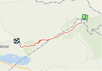
Tocht Te voet van 4,2 km beschikbaar op Campania, Caserta, Letino. Deze tocht wordt voorgesteld door SityTrail - itinéraires balisés pédestres.
Beschrijving
Trail created by Club Alpino Italiano.
Symbol: 113 on white red flags
Plaatsbepaling
Land:
Italy
Regio :
Campania
Departement/Provincie :
Caserta
Gemeente :
Letino
Locatie:
Unknown
Vertrek:(Dec)
Vertrek:(UTM)
439575 ; 4591720 (33T) N.
Opmerkingen