


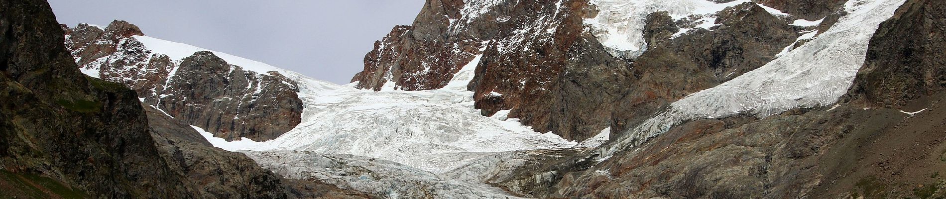
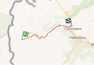
(SI F07) Rifugio Elisabetta - Courmayeur

SityTrail - itinéraires balisés pédestres
Tous les sentiers balisés d’Europe GUIDE+

Lengte
14,9 km

Max. hoogte
2429 m

Positief hoogteverschil
514 m
Km-Effort
25 km

Min. hoogte
1173 m

Negatief hoogteverschil
1461 m
Boucle
Neen

Markering
Datum van aanmaak :
2022-02-15 16:36:30.254
Laatste wijziging :
2022-03-01 19:17:49.928
5h39
Moeilijkheid : Medium

Gratisgps-wandelapplicatie
 SityTrail
IGN / Geografische instituten
SityTrail Plus
De wereld gaat voor u open
Over ons
Tocht Te voet van 14,9 km beschikbaar op Valle d'Aosta, Onbekend, Courmayeur. Deze tocht wordt voorgesteld door SityTrail - itinéraires balisés pédestres.
Beschrijving
Sentiero Italia CAI 2019
Foto's
 Rifugio Elisabetta - Courmayeur - Photo 1")
 Rifugio Elisabetta - Courmayeur - Photo 2")
 Rifugio Elisabetta - Courmayeur - Photo 3")
 Rifugio Elisabetta - Courmayeur - Photo 4")
 Rifugio Elisabetta - Courmayeur - Photo 5")
 Rifugio Elisabetta - Courmayeur - Photo 6")
 Rifugio Elisabetta - Courmayeur - Photo 7")
 Rifugio Elisabetta - Courmayeur - Photo 8")
 Rifugio Elisabetta - Courmayeur - Photo 9")
 Rifugio Elisabetta - Courmayeur - Photo 10")
Plaatsbepaling
Land:
Italy
Regio :
Valle d'Aosta
Departement/Provincie :
Onbekend
Gemeente :
Courmayeur
Locatie:
Unknown
Vertrek:(Dec)
Vertrek:(UTM)
331950 ; 5070364 (32T) N.
Opmerkingen