


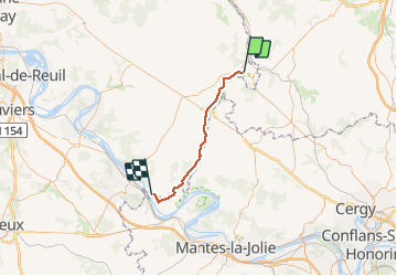
Voie Verte: Gisors=> Giverny:

alaindurbecq
Gebruiker

Lengte
35 km

Max. hoogte
61 m

Positief hoogteverschil
200 m
Km-Effort
38 km

Min. hoogte
12 m

Negatief hoogteverschil
230 m
Boucle
Neen
Datum van aanmaak :
2014-12-10 00:00:00.0
Laatste wijziging :
2014-12-10 00:00:00.0
2h12
Moeilijkheid : Gemakkelijk

Gratisgps-wandelapplicatie
 SityTrail
IGN / Geografische instituten
SityTrail Plus
De wereld gaat voor u open
Over ons
Tocht Fiets van 35 km beschikbaar op Normandië, Eure, Gisors. Deze tocht wordt voorgesteld door alaindurbecq.
Beschrijving
Gasny 27 km / Limetz Villez 33 km / Giverny Résidence Claude Monet 36 km ou 33 par route de Falaise
Plaatsbepaling
Land:
France
Regio :
Normandië
Departement/Provincie :
Eure
Gemeente :
Gisors
Locatie:
Unknown
Vertrek:(Dec)
Vertrek:(UTM)
409893 ; 5458613 (31U) N.
Opmerkingen