


IT-6

SityTrail - itinéraires balisés pédestres
Tous les sentiers balisés d’Europe GUIDE+
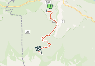

Lengte
4,3 km

Max. hoogte
2116 m

Positief hoogteverschil
780 m
Km-Effort
12,1 km

Min. hoogte
1330 m

Negatief hoogteverschil
0 m
Boucle
Neen

Markering
Datum van aanmaak :
2022-02-17 10:57:09.907
Laatste wijziging :
2022-03-02 01:44:19.101
2h45
Moeilijkheid : Gemakkelijk

Gratisgps-wandelapplicatie
 SityTrail
IGN / Geografische instituten
SityTrail Plus
De wereld gaat voor u open
Over ons
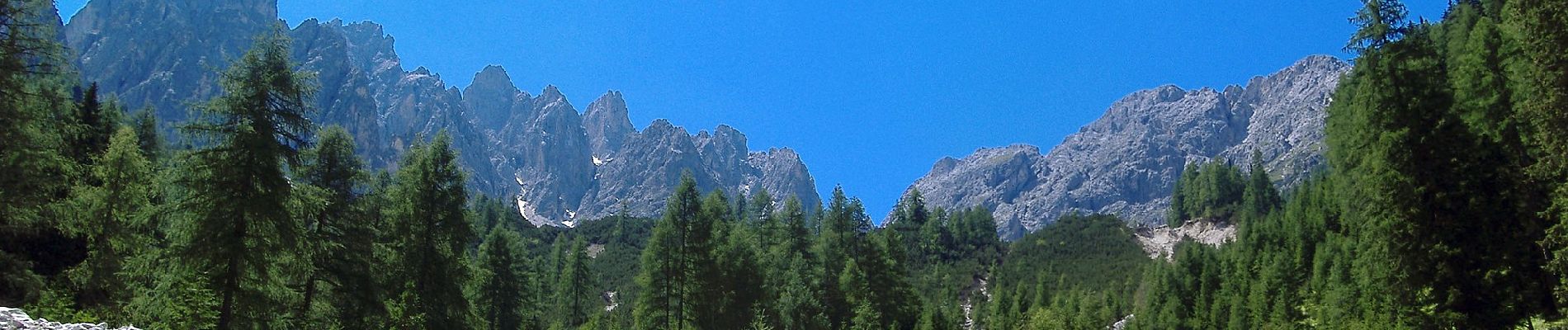
Tocht Te voet van 4,3 km beschikbaar op Trento-Zuid-Tirol, Bolzano - Bozen, Innichen - San Candido. Deze tocht wordt voorgesteld door SityTrail - itinéraires balisés pédestres.
Beschrijving
Trail created by AVS.
Foto's


Plaatsbepaling
Land:
Italy
Regio :
Trento-Zuid-Tirol
Departement/Provincie :
Bolzano - Bozen
Gemeente :
Innichen - San Candido
Locatie:
Innichen
Vertrek:(Dec)
Vertrek:(UTM)
291374 ; 5178117 (33T) N.
Opmerkingen