


J2 DEFINITIF

CASSISFRAMBOISE
Gebruiker

Lengte
18,3 km

Max. hoogte
1674 m

Positief hoogteverschil
932 m
Km-Effort
29 km

Min. hoogte
873 m

Negatief hoogteverschil
396 m
Boucle
Neen
Datum van aanmaak :
2022-03-08 13:13:17.701
Laatste wijziging :
2022-03-08 13:13:38.369
6h34
Moeilijkheid : Medium

Gratisgps-wandelapplicatie
 SityTrail
IGN / Geografische instituten
SityTrail Plus
De wereld gaat voor u open
Over ons
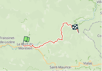
Tocht Te voet van 18,3 km beschikbaar op Occitanië, Lozère, Pont de Montvert - Sud Mont Lozère. Deze tocht wordt voorgesteld door CASSISFRAMBOISE.
Plaatsbepaling
Land:
France
Regio :
Occitanië
Departement/Provincie :
Lozère
Gemeente :
Pont de Montvert - Sud Mont Lozère
Locatie:
Le Pont-de-Montvert
Vertrek:(Dec)
Vertrek:(UTM)
558844 ; 4912567 (31T) N.
Opmerkingen